Area Overview for HD2 1JJ
Photos of HD2 1JJ
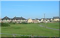
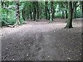
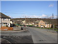
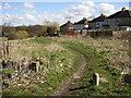
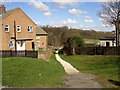
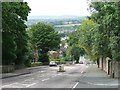
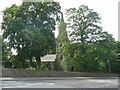

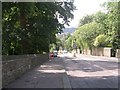
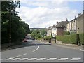
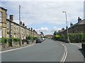
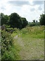
100 photos from this area
Area Information
Key information about the HD2 1JJ including its size, population, and administrative classification.
- Area Type
- Postcode
- Area Size
- 1.1 hectares
- Population
- 1832
- Population Density
- 5747 people/km²
House Prices in HD2 1JJ
46
Properties
£92,844
Average Sold Price
£27,000
Lowest Price
£175,000
Highest Price
Showing 46 properties
| Address | Type | Beds | Baths | Last Sale Price | Last Sale Date | |
|---|---|---|---|---|---|---|
| 214 Deighton Road, Deighton, Huddersfield, HD2 1JJ | Terraced | - | - | £35,000 | Mar 2023 | |
| 194 Deighton Road, Deighton, Huddersfield, HD2 1JJ | house | - | - | £60,500 | Mar 2021 | |
| 200 Deighton Road, Deighton, Huddersfield, HD2 1JJ | Terraced | 2 | 2 | £100,000 | Oct 2019 | |
| 238 Deighton Road, Deighton, Huddersfield, HD2 1JJ | house | - | - | £105,000 | Jul 2019 | |
| 244 Deighton Road, Deighton, Huddersfield, HD2 1JJ | house | - | - | £120,000 | Feb 2018 | |
| 178 Deighton Road, Deighton, Huddersfield, HD2 1JJ | Detached | 4 | 2 | £120,000 | Jan 2018 | |
| Living Accommodation, The Woolpack, 190 Deighton Road, Deighton, Huddersfield, HD2 1JJ | undefined | - | - | £175,000 | Oct 2015 | |
| 190 Deighton Road, Deighton, Huddersfield, HD2 1JJ | Flat | - | - | £175,000 | Oct 2015 | |
| 246 Deighton Road, Deighton, Huddersfield, HD2 1JJ | Terraced | - | - | £134,000 | Nov 2007 | |
| 242 Deighton Road, Deighton, Huddersfield, HD2 1JJ | house | - | - | £123,000 | Oct 2006 |
Page 1 of 5
Energy Efficiency in HD2 1JJ
Amenities
Schools
| Rank | School | Type | Entry gender | Ages |
|---|
Explore more schools in this area
Go to Schools tabDemographics
Household Size
Family (3-5 people)
most common
Accommodation Type
Houses
most common
Tenure
30
majority
Ethnic Group
White
most common
Religion
N/A
most common
Household Composition
N/A
most common
Age
47
median
Adults (30-64 years)
most common
Household Deprivation
N/A
with no deprivation
NS-SEC
15
in Lower managerial occupations
Explore more demographic insights in this area
Go to Demographics tabPlanning
Planning Constraints
- Flood RiskPremium
- Ramsar Wetland SitesPremium
- Area of Outstanding Natural BeautyPremium
- Protected Nature ReservePremium
- Protected WoodlandPremium