Area Overview for HD2 1EE
Photos of HD2 1EE
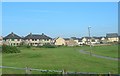
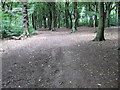
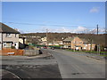
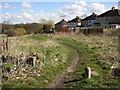
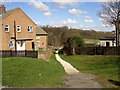
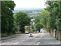
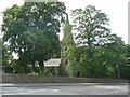

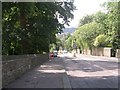
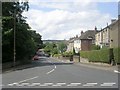
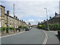
100 photos from this area
Area Information
Key information about the HD2 1EE including its size, population, and administrative classification.
- Area Type
- Postcode
- Area Size
- 2.1 hectares
- Population
- 1333
- Population Density
- 565 people/km²
House Prices in HD2 1EE
34
Properties
£94,940
Average Sold Price
£21,600
Lowest Price
£297,400
Highest Price
Showing 34 properties
| Address | Type | Beds | Baths | Last Sale Price | Last Sale Date | |
|---|---|---|---|---|---|---|
| 17 Leafield Close, Sheepridge, Huddersfield, HD2 1EE | Semi-detached | 3 | 2 | £168,000 | Dec 2024 | |
| 14 Leafield Close, Sheepridge, Huddersfield, HD2 1EE | house | - | - | £297,400 | Nov 2023 | |
| 25 Leafield Close, Sheepridge, Huddersfield, HD2 1EE | house | - | - | £135,000 | Dec 2022 | |
| 7 Leafield Close, Sheepridge, Huddersfield, HD2 1EE | Semi-detached | - | - | £110,000 | Jan 2022 | |
| 18 Leafield Close, Sheepridge, Huddersfield, HD2 1EE | house | - | - | £103,000 | Jan 2022 | |
| 28 Leafield Close, Sheepridge, Huddersfield, HD2 1EE | Semi-detached | 3 | 1 | £92,500 | Nov 2019 | |
| 27 Leafield Close, Sheepridge, Huddersfield, HD2 1EE | Semi-detached | 3 | 1 | £92,000 | Nov 2018 | |
| 12 Leafield Close, Sheepridge, Huddersfield, HD2 1EE | Semi-detached | 3 | 1 | £90,000 | Dec 2017 | |
| 21 Leafield Close, Sheepridge, Huddersfield, HD2 1EE | Semi-detached | 3 | - | £74,000 | Nov 2013 | |
| 32 Leafield Close, Sheepridge, Huddersfield, HD2 1EE | house | - | - | £95,000 | May 2010 |
Page 1 of 4
Energy Efficiency in HD2 1EE
Amenities
Schools
| Rank | School | Type | Entry gender | Ages |
|---|
Explore more schools in this area
Go to Schools tabDemographics
Household Size
Family (3-5 people)
most common
Accommodation Type
Houses
most common
Tenure
86
majority
Ethnic Group
White
most common
Religion
N/A
most common
Household Composition
N/A
most common
Age
47
median
Adults (30-64 years)
most common
Household Deprivation
N/A
with no deprivation
NS-SEC
42
in Lower managerial occupations
Explore more demographic insights in this area
Go to Demographics tabPlanning
Planning Constraints
- Flood RiskPremium
- Ramsar Wetland SitesPremium
- Area of Outstanding Natural BeautyPremium
- Protected Nature ReservePremium
- Protected WoodlandPremium