Area Overview for HD2 1DH
Photos of HD2 1DH
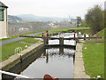
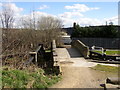
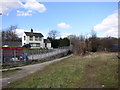
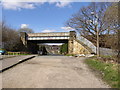
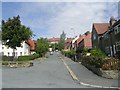
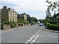
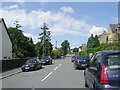
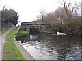
100 photos from this area
Area Information
Key information about the HD2 1DH including its size, population, and administrative classification.
- Area Type
- Postcode
- Area Size
- 4.2 hectares
- Population
- 1561
- Population Density
- 3464 people/km²
House Prices in HD2 1DH
29
Properties
£181,821
Average Sold Price
£70,000
Lowest Price
£315,000
Highest Price
Showing 29 properties
| Address | Type | Beds | Baths | Last Sale Price | Last Sale Date | |
|---|---|---|---|---|---|---|
| 52 Woodhouse Hill, Fartown, Huddersfield, HD2 1DH | house | 3 | 1 | £150,000 | Mar 2025 | |
| 77 Woodhouse Hill, Fartown, Huddersfield, HD2 1DH | Detached | 3 | 1 | £265,000 | May 2023 | |
| 58 Woodhouse Hill, Fartown, Huddersfield, HD2 1DH | house | 1 | 2 | £205,000 | Oct 2021 | |
| 62 Woodhouse Hill, Fartown, Huddersfield, HD2 1DH | Detached | 3 | 1 | £210,000 | Sep 2021 | |
| 71 Woodhouse Hill, Fartown, Huddersfield, HD2 1DH | Detached | 4 | 1 | £250,000 | Aug 2021 | |
| 69 Woodhouse Hill, Fartown, Huddersfield, HD2 1DH | house | 4 | - | £315,000 | Mar 2021 | |
| 56 Woodhouse Hill, Fartown, Huddersfield, HD2 1DH | Detached | 4 | 2 | £210,000 | Aug 2020 | |
| 60 Woodhouse Hill, Fartown, Huddersfield, HD2 1DH | Detached | 4 | 2 | £207,500 | Nov 2018 | |
| 65 Woodhouse Hill, Fartown, Huddersfield, HD2 1DH | residential_space | 1 | 1 | £190,000 | May 2017 | |
| 54 Woodhouse Hill, Fartown, Huddersfield, HD2 1DH | Detached | 4 | - | £100,000 | Jul 2002 |
Page 1 of 3
Energy Efficiency in HD2 1DH
Amenities
Schools
| Rank | School | Type | Entry gender | Ages |
|---|
Explore more schools in this area
Go to Schools tabDemographics
Household Size
One person
most common
Accommodation Type
Houses
most common
Tenure
57
majority
Ethnic Group
White
most common
Religion
N/A
most common
Household Composition
N/A
most common
Age
47
median
Adults (30-64 years)
most common
Household Deprivation
N/A
with no deprivation
NS-SEC
20
in Lower managerial occupations
Explore more demographic insights in this area
Go to Demographics tabPlanning
Planning Constraints
- Flood RiskPremium
- Ramsar Wetland SitesPremium
- Area of Outstanding Natural BeautyPremium
- Protected Nature ReservePremium
- Protected WoodlandPremium