Area Overview for HD1 4LH
Photos of HD1 4LH


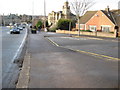

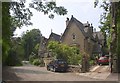
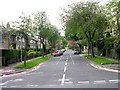
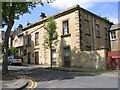

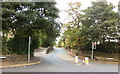
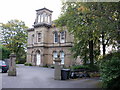
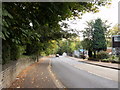
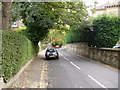
100 photos from this area
Area Information
Key information about the HD1 4LH including its size, population, and administrative classification.
- Area Type
- Postcode
- Area Size
- 1.8 hectares
- Population
- 1445
- Population Density
- 7118 people/km²
House Prices in HD1 4LH
52
Properties
£203,373
Average Sold Price
£2,000
Lowest Price
£410,000
Highest Price
Showing 52 properties
| Address | Type | Beds | Baths | Last Sale Price | Last Sale Date | |
|---|---|---|---|---|---|---|
| 12 Grasmere Road, Gledholt, Huddersfield, HD1 4LH | Flat | - | - | £2,000 | Jun 2025 | |
| 8 Grasmere Road, Gledholt, Huddersfield, HD1 4LH | Terraced | 5 | 4 | £400,000 | May 2024 | |
| 43 Grasmere Road, Gledholt, Huddersfield, HD1 4LH | house | 5 | 2 | £410,000 | Oct 2022 | |
| 41 Grasmere Road, Gledholt, Huddersfield, HD1 4LH | Terraced | 4 | 2 | £300,000 | Apr 2019 | |
| 10 Grasmere Road, Gledholt, Huddersfield, HD1 4LH | Terraced | 4 | 2 | £352,000 | Aug 2017 | |
| 29 Grasmere Road, Gledholt, Huddersfield, HD1 4LH | house | 5 | - | £315,000 | Oct 2016 | |
| 5A Grasmere Road, Gledholt, Huddersfield, HD1 4LH | Flat | - | - | £120,000 | Nov 2013 | |
| 45 Grasmere Road, Gledholt, Huddersfield, HD1 4LH | Terraced | - | - | £268,500 | Apr 2007 | |
| 39 Grasmere Road, Gledholt, Huddersfield, HD1 4LH | Terraced | - | - | £198,500 | Apr 2005 | |
| 47 Grasmere Road, Gledholt, Huddersfield, HD1 4LH | Terraced | 4 | 2 | £57,450 | Feb 2003 |
Page 1 of 6
Energy Efficiency in HD1 4LH
Amenities
Schools
| Rank | School | Type | Entry gender | Ages |
|---|
Explore more schools in this area
Go to Schools tabDemographics
Household Size
One person
most common
Accommodation Type
Houses
most common
Tenure
58
majority
Ethnic Group
White
most common
Religion
N/A
most common
Household Composition
N/A
most common
Age
47
median
Adults (30-64 years)
most common
Household Deprivation
N/A
with no deprivation
NS-SEC
35
in Lower managerial occupations
Explore more demographic insights in this area
Go to Demographics tabPlanning
Planning Constraints
- Flood RiskPremium
- Ramsar Wetland SitesPremium
- Area of Outstanding Natural BeautyPremium
- Protected Nature ReservePremium
- Protected WoodlandPremium