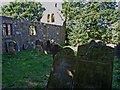
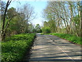
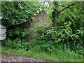
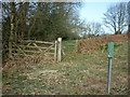
Area Overview for Harwood Dale
Photos of Harwood Dale
Area Information
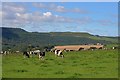
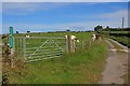
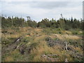
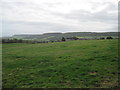
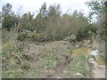
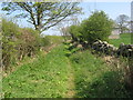
Harwood Dale is a civil parish covering 24.9 square kilometres in England. You will find this area distinctively quiet, defined more by its layout and environmental boundaries than by a dense urban energy. The landscape here includes significant portions of protected woodland and nature reserves, which shapes the daily experience for anyone looking at homes in Harwood Dale. These natural features mean your immediate surroundings will often feel rural and open rather than suburban. Living in Harwood Dale offers a setting where green spaces are integral to the community fabric. While the physical size is moderate, the character is defined by conservation status rather than commercial development. You are entering a space where planning policies actively protect the natural environment. This creates a stable and predictable immediate environment for residents who value quiet. The area lacks major planning constraints like Ramsar wetland sites or Area of Outstanding Natural Beauty designation, though the presence of protected woodlands and nature reserves remains a key geographical feature. This balance allows for a settled atmosphere without the bureaucratic restrictions found in stricter conservation zones. You should enter this community with an appreciation for its green infrastructure and the specific limits these protections place on future change.
- Area Type
- Parish
- Area Size
- 24.9 km²
- Population
- Not available
- Population Density
- Not available
Demographics
The community in Harwood Dale is heavily weighted towards older residents, with a median age of 70 years. This reflects a demographic where the average household head is significantly older than the national average. Most people in this parish fall into the older age bracket, meaning you will see fewer young families or students compared to other parts of the country. Home ownership stands at 79 per cent, indicating that the vast majority of residents have purchased their properties rather than renting. This high rate suggests long-term settlement rather than a transient rental market. Accommodation types and ethnic diversity data are not provided for Harwood Dale, so no specific conclusions can be drawn regarding diversity or housing styles. However, the age profile strongly suggests a community focused on retirement or older retirees. This demographic reality influences the local services and social atmosphere you would experience. You are looking at an area where life pace is likely slower and social interactions revolve around established networks. The environment suits those seeking a quiet retirement or a neighbourhood where neighbours have lived there for decades. Understanding this age structure helps you gauge the community feel before you commit to buying a home here.
Household Size
Accommodation Type
Tenure
Ethnic Group
Religion
Household Composition
Age
Household Deprivation
NS-SEC
Explore more demographic insights in this area
Go to Demographics tabPlanning
Planning Constraints
- Flood RiskPremium
- Ramsar Wetland SitesPremium
- Area of Outstanding Natural BeautyPremium
- Protected Nature ReservePremium
- Protected WoodlandPremium
- Crime RiskPremium