Area Overview for Fishergate Ward
Photos of Fishergate Ward


Area Information
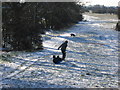
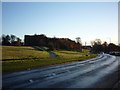
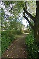
Fishergate Ward sits within the historic boundaries of York City Council, covering a compact district of 2.3 square kilometres. This electoral ward stretches from the city walls along Fulford Road down to the village days away. It includes all terraced streets alongside New Walk, forming a integral part of the area that drew new boundaries after the May 2015 elections. Living in Fishergate Ward means residing in a neighbourhood defined by its proximity to these historic landmarks while accessing the residential streets that characterise the Fulford Road corridor. The area encompasses a specific slice of life that bridges the urban environment with the approach to the rural village. You are positioned on land that has been managed as a single administrative unit since the 2015 reorganisation. This structure creates a cohesive community where daily life is shaped by the specific layout of terraced housing around New Walk and the main thoroughfare beyond. The ward represents a distinct zone within the wider city, offering access to local amenities while maintaining a direct route out of the historic core towards Fulford. Your daily journey here is dictated by these established roads and the clear geographic lines of the ward boundary. It is a defined space where the transition from city wall to village road happens without the confusion of overlapping towns.
- Area Type
- District Borough Unitary Ward
- Area Size
- 2.3 km²
- Population
- Not available
- Population Density
- Not available
Demographics
The community in Fishergate Ward displays a clear demographic profile driven by age and tenure. The median age for residents is 70, indicating a population dominated by older adults. This figure places the area significantly beyond the national average where young families or students would drive the population balance. Nearly half of all residents, accounting for 49 per cent, own their homes outright or with a mortgage. This high level of ownership suggests deep roots within the community and stability for long-term living arrangements. The remaining households rely on rental accommodation, reflecting a mix of ownership models typical for an area with a large senior cohort. Specific data regarding household composition, predominant ethnicity, and religious demographics are not detailed in the current profile, so the narrative focuses on the clear age and tenure split. This age structure influences local services and social activities, creating a community where daily life revolves around the needs of those over seventy. You should expect a neighbourhood where long-term residents form the majority of the streets along Fulford Road and New Walk.
Household Size
Accommodation Type
Tenure
Ethnic Group
Religion
Household Composition
Age
Household Deprivation
NS-SEC
Explore more demographic insights in this area
Go to Demographics tabPlanning
Planning Constraints
- Flood RiskPremium
- Ramsar Wetland SitesPremium
- Area of Outstanding Natural BeautyPremium
- Protected Nature ReservePremium
- Protected WoodlandPremium
- Crime RiskPremium