Area Overview for East Garton
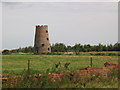
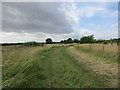
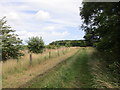
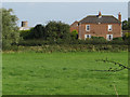
Photos of East Garton


Area Information
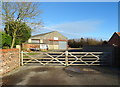
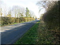
You are entering a quiet corner of England when you live in East Garton. This civil parish stretches across 13.3 square kilometres, offering a rural setting typical of the region. The landscape remains largely undeveloped, containing no Ramsar wetland sites or Areas of Outstanding Natural Beauty. You will encounter protected woodland within the parish boundaries, which adds a natural element to the local scenery. Safety is a priority for residents, with the area recording notably low crime rates against a national average. This factual safety record contributes to a stable environment for families and retirees alike. The absence of significant planning constraints means the immediate character of East Garton is unlikely to face major external changes. Digital connectivity presents a mixed picture for modern living. While mobile networks perform well, fixed broadband quality lags behind urban standards. You must weigh this connectivity gap against the tranquillity of the location. The median age suggests a community settled into its rhythm, away from the rapid pace of city life. Every aspect of life here is defined by these tangible facts rather than abstract promises of vibrancy or exclusivity.
- Area Type
- Parish
- Area Size
- 13.3 km²
- Population
- Not available
- Population Density
- Not available
Demographics
The community profile in East Garton reflects a settled population with a clear generational balance. The median age is 70 years, indicating that retirees are the dominant demographic across the parish. Most common age statistics confirm that the total population leans heavily towards older age brackets. You are likely to encounter neighbours who have called this area home for decades, fostering a quiet and familiar atmosphere. Home ownership stands at 71%, meaning fewer than three out of every ten residents are renting their homes in East Garton. This high rate of ownership typically correlates with long-term stability and fewer transient populations. Household composition and accommodation types follow standard patterns for rural parishes without specific deviations noted in the data. Deprivation metrics are not highlighted in the current records, focusing attention instead on the established nature of the community. The ethnic group and religious data are aggregated as total figures, avoiding specific breakdowns that might dilute the clear portrait of an older, owner-occupied village. Residents here generally value the established social fabric over rapid demographic shifts.
Household Size
Accommodation Type
Tenure
Ethnic Group
Religion
Household Composition
Age
Household Deprivation
NS-SEC
Explore more demographic insights in this area
Go to Demographics tabPlanning
Planning Constraints
- Flood RiskLocked
- Ramsar Wetland SitesLocked
- Area of Outstanding Natural BeautyLocked
- Protected Nature ReserveLocked
- Protected WoodlandLocked
- Crime RiskLocked