Area Overview for DN9 2WW
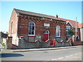
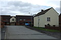
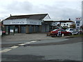
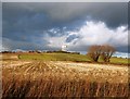
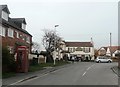
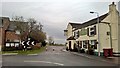
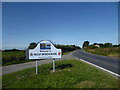
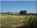
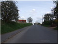
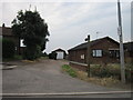
Photos of DN9 2WW


Area Information
Living in DN9 2WW offers a compact, tightly knit residential experience in a small cluster of homes across England. With a population of 1,630 and a density of 631 people per square kilometre, this area balances privacy with proximity to essential services. The community is characterised by a mature demographic, with a median age of 47 and a majority of residents aged 30–64. This suggests a stable, long-term presence of families and professionals. The area’s small size means daily life is likely centred around local amenities and familiar surroundings. While it lacks large-scale infrastructure, its proximity to Robin Hood Doncaster Sheffield Airport and a handful of retail outlets provides practical connectivity. The absence of major planning constraints or environmental restrictions makes it a straightforward place to live, with no unexpected barriers to development or land use. For those seeking a quiet, low-maintenance lifestyle with a focus on home ownership, DN9 2WW’s straightforward appeal is evident.
- Area Type
- Postcode
- Area Size
- Not available
- Population
- 1630
- Population Density
- 631 people/km²
The property market in DN9 2WW is dominated by owner-occupied homes, with 89% of residents living in properties they own. This high rate of home ownership indicates a stable market where long-term residency is the norm rather than short-term rental activity. The accommodation type is exclusively houses, which suggests a focus on family homes or single-family living. Given the small size of the area, the housing stock is likely limited to a few dozen properties, making it a niche market for buyers seeking a quiet, low-density environment. The absence of rental properties or flats implies that this is not a hotspot for investors or transient populations. For those considering a purchase, the emphasis on home ownership and the lack of planning constraints mean the area is practical for those prioritising security and a settled lifestyle over proximity to urban amenities.
House Prices in DN9 2WW
No properties found in this postcode.
Energy Efficiency in DN9 2WW
Residents of DN9 2WW have access to a modest but functional selection of amenities. The area includes four retail outlets, notably Lincolnshire Co-operative Co and Co-op Mowbray, offering basic grocery and household needs. The nearest major transport hub is Robin Hood Doncaster Sheffield Airport, providing regional flight connections. While the data does not mention parks or leisure facilities, the absence of environmental restrictions suggests open spaces may be available nearby. The retail presence ensures daily errands can be managed locally, reducing the need for long commutes. However, the limited number of amenities means residents may need to travel further for more specialised services or entertainment. The character of the area is defined by practicality, with a focus on essential services rather than a vibrant commercial or cultural scene.
Amenities
Schools
| Rank | School | Type | Entry gender | Ages |
|---|
Explore more schools in this area
Go to Schools tabDemographics
The community in DN9 2WW is predominantly composed of adults aged 30–64, reflecting a mature population with a median age of 47. This age group suggests a mix of established families and professionals in their middle years. Home ownership is exceptionally high at 89%, indicating a strong preference for long-term residency over rental living. The accommodation type is primarily houses, which aligns with the demographic’s likely need for family-friendly spaces. The predominant ethnic group is White, though the data does not specify further diversity metrics. The absence of detailed information on deprivation or socioeconomic variation means the quality of life here is inferred from the stability of home ownership and the low risk assessments. This suggests a community focused on security and continuity, with limited exposure to the challenges often faced by areas with higher turnover or economic disparity.
Household Size
Accommodation Type
Tenure
Ethnic Group
Religion
Household Composition
Age
Household Deprivation
NS-SEC
Explore more demographic insights in this area
Go to Demographics tabPlanning
Planning Constraints
- Flood RiskPremium
- Ramsar Wetland SitesPremium
- Area of Outstanding Natural BeautyPremium
- Protected Nature ReservePremium
- Protected WoodlandPremium
- Crime RiskPremium