Area Overview for DN8 4UA
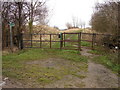
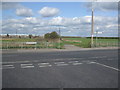
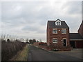
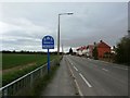
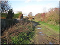
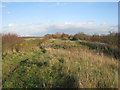
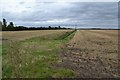
Photos of DN8 4UA

Area Information
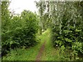
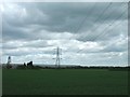
DN8 4UA is a small residential cluster in England, home to 1,953 people spread across a densely populated area of 852 people per square kilometre. This compact postcode area reflects a community rooted in stability, with a median age of 47 and a majority of residents aged between 30 and 64. The area’s character is defined by its focus on housing, with 60% of properties owner-occupied and the majority being houses rather than flats. Living here means navigating a tight-knit, practical environment where daily life is shaped by proximity to essential services. Retail options include Lidl Thorne, Sainsburys Thorne, and Heron Thorne, while rail access is robust, with five stations within reach, including Thorne North and South. The area’s low flood risk and absence of protected natural sites suggest a pragmatic, low-constraint environment. However, crime rates are around average, requiring standard security measures. For those seeking a balance between convenience and a grounded lifestyle, DN8 4UA offers a snapshot of suburban England.
- Area Type
- Postcode
- Area Size
- Not available
- Population
- 1953
- Population Density
- 852 people/km²
DN8 4UA is a housing-led area where 60% of properties are owner-occupied, and the majority are houses rather than flats. This suggests a market skewed toward long-term residents and families seeking stability. The compact nature of the postcode means the housing stock is limited, with no indication of a significant rental sector. Buyers should expect a focus on single-family homes, which may appeal to those prioritising space and privacy. The absence of high-density housing or commercial development implies a quiet, residential character. Given the area’s small size, property values are likely influenced by local amenities and transport links, such as nearby railway stations and retail hubs. For those seeking a low-maintenance, owner-occupied home, DN8 4UA offers a straightforward, if unremarkable, proposition.
House Prices in DN8 4UA
No properties found in this postcode.
Energy Efficiency in DN8 4UA
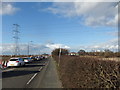
Daily life in DN8 4UA is shaped by its proximity to retail and transport hubs. The area’s five retail outlets include Lidl Thorne, Sainsburys Thorne, and Heron Thorne, offering essential shopping and dining options. For commuters, five railway stations—such as Thorne North and Hatfield & Stainforth—provide straightforward access to nearby employment centres. While the area lacks expansive parks or leisure facilities, its practical amenities cater to everyday needs without requiring long commutes. The presence of multiple retail and rail options suggests a community prioritising convenience over luxury. Residents can expect a lifestyle defined by simplicity, with local shops and stations forming the backbone of daily routines.
Amenities
Schools
| Rank | School | Type | Entry gender | Ages |
|---|
Explore more schools in this area
Go to Schools tabDemographics
The population of DN8 4UA is predominantly adults aged 30–64, with a median age of 47. This suggests a mature, established community with a focus on long-term residency. Home ownership is strong, at 60%, and the primary accommodation type is houses, indicating a preference for single-family living over flats. The predominant ethnic group is White, which aligns with broader regional trends. The absence of specific data on deprivation or diversity metrics means the area’s social composition remains largely unexamined in public records. However, the age profile and ownership figures suggest a stable, middle-aged population with a strong sense of place. For those considering a move, the area’s demographics reflect a community that values continuity and practical living over transient urban dynamics.
Household Size
Accommodation Type
Tenure
Ethnic Group
Religion
Household Composition
Age
Household Deprivation
NS-SEC
Explore more demographic insights in this area
Go to Demographics tabPlanning
Planning Constraints
- Flood RiskPremium
- Ramsar Wetland SitesPremium
- Area of Outstanding Natural BeautyPremium
- Protected Nature ReservePremium
- Protected WoodlandPremium