Area Overview for DN7 6LE
Photos of DN7 6LE
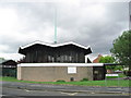
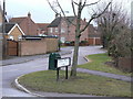
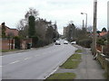
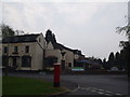
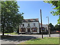
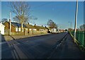
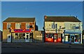
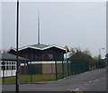
21 photos from this area
Area Information
Key information about the DN7 6LE including its size, population, and administrative classification.
- Area Type
- Postcode
- Area Size
- 8053 m²
- Population
- 1531
- Population Density
- 1016 people/km²
House Prices in DN7 6LE
13
Properties
£140,944
Average Sold Price
£45,500
Lowest Price
£227,500
Highest Price
Showing 13 properties
| Address | Type | Beds | Baths | Last Sale Price | Last Sale Date | |
|---|---|---|---|---|---|---|
| 75 Crookes Broom Lane, Hatfield, Doncaster, DN7 6LE | house | - | - | £92,500 | Feb 2023 | |
| 61 Crookes Broom Lane, Hatfield, Doncaster, DN7 6LE | Bungalow | 3 | - | £227,500 | Jul 2022 | |
| 63 Crookes Broom Lane, Hatfield, Doncaster, DN7 6LE | house | - | - | £174,995 | Feb 2022 | |
| 71 Crookes Broom Lane, Hatfield, Doncaster, DN7 6LE | Semi-detached | 3 | 1 | £161,000 | Dec 2021 | |
| 55 Crookes Broom Lane, Hatfield, Doncaster, DN7 6LE | Bungalow | - | - | £145,000 | Nov 2021 | |
| 65 Crookes Broom Lane, Hatfield, Doncaster, DN7 6LE | Semi-detached | 3 | 1 | £117,000 | Aug 2019 | |
| 59 Crookes Broom Lane, Hatfield, Doncaster, DN7 6LE | Bungalow | 3 | 1 | £180,000 | Aug 2019 | |
| 53 Crookes Broom Lane, Hatfield, Doncaster, DN7 6LE | Bungalow | 3 | 1 | £125,000 | Sep 2010 | |
| 69 Crookes Broom Lane, Hatfield, Doncaster, DN7 6LE | house | - | - | £45,500 | Nov 1997 | |
| 73 Crookes Broom Lane, Hatfield, Doncaster, DN7 6LE | Semi-detached | - | - | - | - |
Page 1 of 2
Energy Efficiency in DN7 6LE
Amenities
Schools
| Rank | School | Type | Entry gender | Ages |
|---|
Explore more schools in this area
Go to Schools tabDemographics
Household Size
Two person
most common
Accommodation Type
Houses
most common
Tenure
77
majority
Ethnic Group
White
most common
Religion
N/A
most common
Household Composition
N/A
most common
Age
47
median
Adults (30-64 years)
most common
Household Deprivation
N/A
with no deprivation
NS-SEC
25
in Lower managerial occupations
Explore more demographic insights in this area
Go to Demographics tabPlanning
Planning Constraints
- Flood RiskPremium
- Ramsar Wetland SitesPremium
- Area of Outstanding Natural BeautyPremium
- Protected Nature ReservePremium
- Protected WoodlandPremium