Area Overview for DN7 5LN
Photos of DN7 5LN
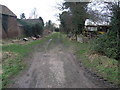
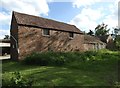
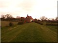
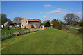

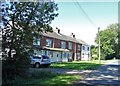
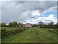


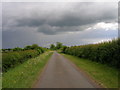


19 photos from this area
Area Information
Key information about the DN7 5LN including its size, population, and administrative classification.
- Area Type
- Postcode
- Area Size
- 27.9 hectares
- Population
- 1403
- Population Density
- 49 people/km²
House Prices in DN7 5LN
19
Properties
£193,450
Average Sold Price
£76,000
Lowest Price
£360,000
Highest Price
Showing 19 properties
| Address | Type | Beds | Baths | Last Sale Price | Last Sale Date | |
|---|---|---|---|---|---|---|
| 5, Willow Cottages, Trundle Lane, Fishlake, Doncaster, DN7 5LN | Terraced | 2 | 1 | £155,000 | Sep 2024 | |
| 4, Willow Cottages, Trundle Lane, Fishlake, Doncaster, DN7 5LN | Terraced | 2 | 1 | £140,000 | Aug 2023 | |
| Jay View, Trundle Lane, Fishlake, Doncaster, DN7 5LN | Bungalow | - | - | £234,000 | Aug 2021 | |
| 6, Willow Cottages, Trundle Lane, Fishlake, Doncaster, DN7 5LN | Terraced | 3 | 1 | £115,000 | Mar 2021 | |
| Long Meadow, Trundle Lane, Fishlake, Doncaster, DN7 5LN | Bungalow | 4 | 2 | £290,000 | Dec 2017 | |
| Holme Lea, Trundle Lane, Fishlake, Doncaster, DN7 5LN | Detached | 3 | 1 | £360,000 | Sep 2017 | |
| Walnut Cottage, Trundle Lane, Fishlake, Doncaster, DN7 5LN | Detached | 4 | - | £260,000 | Sep 2015 | |
| Mount Pleasant, Trundle Lane, Fishlake, Doncaster, DN7 5LN | Detached | - | - | £155,000 | Sep 2012 | |
| The Willows, Trundle Lane, Fishlake, Doncaster, DN7 5LN | house | - | - | £149,500 | Jun 2006 | |
| Fairfields, Trundle Lane, Fishlake, Doncaster, DN7 5LN | Semi-detached | 3 | 1 | £76,000 | Feb 2002 |
Page 1 of 2
Energy Efficiency in DN7 5LN
Amenities
Schools
| Rank | School | Type | Entry gender | Ages |
|---|
Explore more schools in this area
Go to Schools tabDemographics
Household Size
Two person
most common
Accommodation Type
Houses
most common
Tenure
86
majority
Ethnic Group
White
most common
Religion
N/A
most common
Household Composition
N/A
most common
Age
47
median
Adults (30-64 years)
most common
Household Deprivation
N/A
with no deprivation
NS-SEC
34
in Lower managerial occupations
Explore more demographic insights in this area
Go to Demographics tabPlanning
Planning Constraints
- Flood RiskPremium
- Ramsar Wetland SitesPremium
- Area of Outstanding Natural BeautyPremium
- Protected Nature ReservePremium
- Protected WoodlandPremium