Area Overview for DN7 4PH
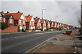
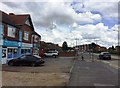
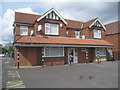
Photos of DN7 4PH


Area Information
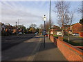
Living in DN7 4PH means being part of a tightly knit residential cluster in England, where 1,345 residents share a community defined by stability and low population density. At 508 people per square kilometre, the area is small but functional, offering a quiet alternative to urban sprawl. The postcode’s proximity to rail networks and a regional airport ensures connectivity without the congestion of larger cities. Daily life here is shaped by a mature demographic—many residents are in their 30s to 60s, with a median age of 47. This suggests a community focused on established living, where homes are predominantly owner-occupied. The area’s appeal lies in its balance: practical amenities like supermarkets and rail stations are within reach, yet the environment remains unencumbered by environmental restrictions or high-risk zones. For those seeking a low-maintenance lifestyle with reliable infrastructure, DN7 4PH offers a snapshot of traditional English suburbia, where familiarity and convenience coexist.
- Area Type
- Postcode
- Area Size
- Not available
- Population
- 1345
- Population Density
- 508 people/km²
The property market in DN7 4PH is dominated by owner-occupied homes, with 92% of properties owned by their residents. This high rate of home ownership suggests a community where long-term investment is the norm, and rental properties are relatively rare. The area’s housing stock consists primarily of houses, which may appeal to families or individuals seeking more space than a flat would offer. Given the small size of the postcode area, the available housing stock is likely limited, making properties here potentially competitive for buyers. The focus on owner-occupied homes also implies a lower turnover rate, which can contribute to a stable and cohesive neighbourhood. For buyers, this means a market where properties are likely to retain value, though the limited supply may mean fewer options for those seeking immediate purchase.
House Prices in DN7 4PH
No properties found in this postcode.
Energy Efficiency in DN7 4PH
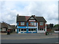
Residents of DN7 4PH have access to a range of practical amenities within walking or short driving distance. Retail options include Co-op Dunscroft, Tesco Doncaster, and Co-op Kirk, providing everyday shopping needs. The area’s rail network, with stations like Hatfield & Stainforth and Thorne South, offers convenient links to nearby towns, while the Robin Hood Doncaster Sheffield Airport adds flexibility for travel. Though the area is small, these amenities collectively support a lifestyle that balances local convenience with regional connectivity. The presence of multiple supermarkets and rail stations suggests a community prioritising accessibility, ensuring residents can meet daily needs without lengthy commutes. For those who prefer a self-contained but connected existence, DN7 4PH offers a blend of practicality and proximity to essential services.
Amenities
Schools
| Rank | School | Type | Entry gender | Ages |
|---|
Explore more schools in this area
Go to Schools tabDemographics
The community in DN7 4PH is predominantly composed of adults aged 30 to 64, with a median age of 47. This reflects a mature, settled population, many of whom are likely long-term residents. Home ownership is exceptionally high at 92%, indicating a stable housing market where most properties are occupied by their owners rather than renters. The area is characterised by houses rather than flats, which aligns with the demographic’s preference for family-friendly or long-term living. The predominant ethnic group is White, which is consistent with broader regional trends. While specific data on deprivation is absent, the high home ownership and low population density suggest a community with access to essential services and a lower reliance on social housing. This profile indicates a quality of life rooted in stability, with residents likely prioritising security and continuity over transient living.
Household Size
Accommodation Type
Tenure
Ethnic Group
Religion
Household Composition
Age
Household Deprivation
NS-SEC
Explore more demographic insights in this area
Go to Demographics tabPlanning
Planning Constraints
- Flood RiskPremium
- Ramsar Wetland SitesPremium
- Area of Outstanding Natural BeautyPremium
- Protected Nature ReservePremium
- Protected WoodlandPremium