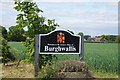
Area Overview for DN6 9JX
Photos of DN6 9JX
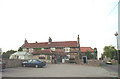
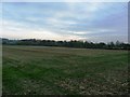
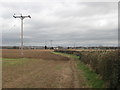
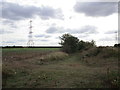
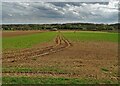
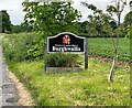
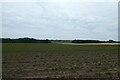
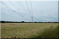
18 photos from this area
Area Information
Key information about the DN6 9JX including its size, population, and administrative classification.
- Area Type
- Postcode
- Area Size
- 67.8 hectares
- Population
- 1705
- Population Density
- 109 people/km²
House Prices in DN6 9JX
21
Properties
£125,106
Average Sold Price
£56,000
Lowest Price
£220,000
Highest Price
Showing 21 properties
| Address | Type | Beds | Baths | Last Sale Price | Last Sale Date | |
|---|---|---|---|---|---|---|
| Stone House Barn, Suttonfield Road, Sutton, Doncaster, DN6 9JX | house | - | - | £150,000 | May 2020 | |
| Fern Royd, Suttonfield Road, Sutton, Doncaster, DN6 9JX | Semi-detached | 3 | - | £140,000 | Feb 2016 | |
| Brookmount, Suttonfield Road, Sutton, Doncaster, DN6 9JX | Semi-detached | - | - | £100,000 | Jan 2014 | |
| Ladygap Cottage, Suttonfield Road, Sutton, Doncaster, DN6 9JX | house | - | - | £220,000 | Jan 2014 | |
| Springfield House, Suttonfield Road, Sutton, Doncaster, DN6 9JX | Semi-detached | - | - | £156,000 | Nov 2009 | |
| Longview, Suttonfield Road, Sutton, Doncaster, DN6 9JX | Semi-detached | - | - | £189,950 | Mar 2007 | |
| Fairview, Suttonfield Road, Sutton, Doncaster, DN6 9JX | house | - | - | £57,000 | Apr 2000 | |
| Sandarest, Suttonfield Road, Sutton, Doncaster, DN6 9JX | house | - | - | £57,000 | Mar 2000 | |
| Rockley Dene, Suttonfield Road, Sutton, Doncaster, DN6 9JX | Semi-detached | - | - | £56,000 | Aug 1995 | |
| Old Hall Farm, Suttonfield Road, Sutton, Doncaster, DN6 9JX | Land | 4 | 2 | - | - |
Page 1 of 3
Energy Efficiency in DN6 9JX
Amenities
Schools
| Rank | School | Type | Entry gender | Ages |
|---|
Explore more schools in this area
Go to Schools tabDemographics
Household Size
Two person
most common
Accommodation Type
Houses
most common
Tenure
74
majority
Ethnic Group
White
most common
Religion
N/A
most common
Household Composition
N/A
most common
Age
47
median
Adults (30-64 years)
most common
Household Deprivation
N/A
with no deprivation
NS-SEC
31
in Lower managerial occupations
Explore more demographic insights in this area
Go to Demographics tabPlanning
Planning Constraints
- Flood RiskPremium
- Ramsar Wetland SitesPremium
- Area of Outstanding Natural BeautyPremium
- Protected Nature ReservePremium
- Protected WoodlandPremium