Area Overview for DN6 9HF
Photos of DN6 9HF
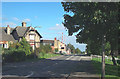
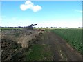
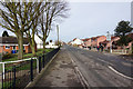
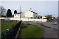
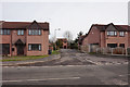
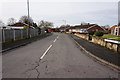
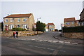
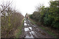
28 photos from this area
Area Information
Key information about the DN6 9HF including its size, population, and administrative classification.
- Area Type
- Postcode
- Area Size
- 2.3 hectares
- Population
- 2091
- Population Density
- 434 people/km²
House Prices in DN6 9HF
34
Properties
£178,391
Average Sold Price
£50,000
Lowest Price
£440,000
Highest Price
Showing 34 properties
| Address | Type | Beds | Baths | Last Sale Price | Last Sale Date | |
|---|---|---|---|---|---|---|
| 5 Station Road, Norton, Doncaster, DN6 9HF | Terraced | 2 | 1 | £130,000 | Jul 2025 | |
| Valley Lodge, Station Road, Norton, Doncaster, DN6 9HF | Bungalow | 4 | 2 | £365,000 | Feb 2024 | |
| 7 Station Road, Norton, Doncaster, DN6 9HF | Terraced | 3 | 2 | £167,000 | Aug 2023 | |
| Springfield House, Station Road, Norton, Doncaster, DN6 9HF | Bungalow | 4 | 1 | £375,000 | May 2023 | |
| Shelton House, Station Road, Norton, Doncaster, DN6 9HF | Bungalow | 2 | 1 | £200,000 | Mar 2023 | |
| Ivedene, Station Road, Norton, Doncaster, DN6 9HF | Bungalow | 3 | 3 | £405,000 | Feb 2023 | |
| 12 Station Road, Norton, Doncaster, DN6 9HF | Terraced | 2 | 2 | £107,000 | Oct 2022 | |
| Ivy Holme, Station Road, Norton, Doncaster, DN6 9HF | Terraced | 2 | 1 | £143,000 | Dec 2021 | |
| Eastfield Lodge, Station Road, Norton, Doncaster, DN6 9HF | house | - | - | £440,000 | Sep 2021 | |
| 9 Station Road, Norton, Doncaster, DN6 9HF | house | - | - | £62,000 | Jun 2021 |
Page 1 of 4
Energy Efficiency in DN6 9HF
Amenities
Schools
| Rank | School | Type | Entry gender | Ages |
|---|
Explore more schools in this area
Go to Schools tabDemographics
Household Size
Two person
most common
Accommodation Type
Houses
most common
Tenure
70
majority
Ethnic Group
White
most common
Religion
N/A
most common
Household Composition
N/A
most common
Age
47
median
Adults (30-64 years)
most common
Household Deprivation
N/A
with no deprivation
NS-SEC
26
in Lower managerial occupations
Explore more demographic insights in this area
Go to Demographics tabPlanning
Planning Constraints
- Flood RiskPremium
- Ramsar Wetland SitesPremium
- Area of Outstanding Natural BeautyPremium
- Protected Nature ReservePremium
- Protected WoodlandPremium