Area Overview for DN6 8RJ
Photos of DN6 8RJ
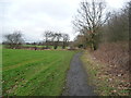
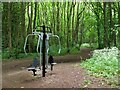
![Exercise equipment in Stony Flat Plantation [1] in DN6 8RJ](https://images.propbar.co.uk/images/geograph/56/32/5632002_120.jpg)

19 photos from this area
Area Information
Key information about the DN6 8RJ including its size, population, and administrative classification.
- Area Type
- Postcode
- Area Size
- 1.1 hectares
- Population
- 1259
- Population Density
- 1848 people/km²
House Prices in DN6 8RJ
32
Properties
£118,491
Average Sold Price
£38,000
Lowest Price
£199,950
Highest Price
Showing 32 properties
| Address | Type | Beds | Baths | Last Sale Price | Last Sale Date | |
|---|---|---|---|---|---|---|
| 7 Crossfield Drive, Skellow, Doncaster, DN6 8RJ | Semi-detached | 3 | 2 | £145,000 | Oct 2023 | |
| 14 Crossfield Drive, Skellow, Doncaster, DN6 8RJ | Detached | 3 | 1 | £120,000 | Jul 2023 | |
| 19 Crossfield Drive, Skellow, Doncaster, DN6 8RJ | house | 2 | 1 | £135,000 | Jan 2023 | |
| 32 Crossfield Drive, Skellow, Doncaster, DN6 8RJ | Detached | 2 | 1 | £127,000 | Dec 2022 | |
| 21 Crossfield Drive, Skellow, Doncaster, DN6 8RJ | Semi-detached | 2 | - | £132,000 | Aug 2022 | |
| 9 Crossfield Drive, Skellow, Doncaster, DN6 8RJ | Semi-detached | 2 | 1 | £90,000 | Apr 2021 | |
| 5 Crossfield Drive, Skellow, Doncaster, DN6 8RJ | Detached | 4 | 2 | £125,000 | Sep 2020 | |
| 28 Crossfield Drive, Skellow, Doncaster, DN6 8RJ | Detached | 4 | 2 | £182,000 | Apr 2019 | |
| 17 Crossfield Drive, Skellow, Doncaster, DN6 8RJ | house | - | - | £103,000 | Mar 2019 | |
| 3 Crossfield Drive, Skellow, Doncaster, DN6 8RJ | Detached | 4 | 2 | £147,000 | Feb 2017 |
Page 1 of 4
Energy Efficiency in DN6 8RJ
Amenities
Schools
| Rank | School | Type | Entry gender | Ages |
|---|
Explore more schools in this area
Go to Schools tabDemographics
Household Size
Two person
most common
Accommodation Type
Houses
most common
Tenure
72
majority
Ethnic Group
White
most common
Religion
N/A
most common
Household Composition
N/A
most common
Age
47
median
Adults (30-64 years)
most common
Household Deprivation
N/A
with no deprivation
NS-SEC
27
in Lower managerial occupations
Explore more demographic insights in this area
Go to Demographics tabPlanning
Planning Constraints
- Flood RiskPremium
- Ramsar Wetland SitesPremium
- Area of Outstanding Natural BeautyPremium
- Protected Nature ReservePremium
- Protected WoodlandPremium