Area Overview for DN6 7UR
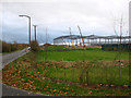
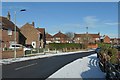
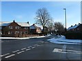
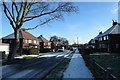
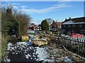
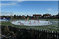
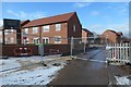
Photos of DN6 7UR


Area Information
DN6 7UR is a small, tightly knit residential cluster in England with a population of 1987 people. This area is characterised by its compact size and the presence of established housing stock, primarily owner-occupied homes. The community is predominantly composed of adults aged 30–64, reflecting a mature demographic profile. Daily life here is shaped by proximity to essential services, including five retail outlets such as Co-op Woodlands and Heron Adwick, and five railway stations, including Adwick and Bentley stations, which provide reliable access to nearby towns. The area’s digital infrastructure is robust, with a broadband score of 99, ensuring seamless connectivity for both work and leisure. While the population is small, the area’s accessibility to rail networks and local shops creates a self-contained yet connected environment. For those seeking a quiet, residential setting with practical amenities, DN6 7UR offers a balance of convenience and tranquillity. Its low flood risk and lack of environmental constraints further enhance its appeal for long-term living.
- Area Type
- Postcode
- Area Size
- Not available
- Population
- 1987
- Population Density
- 2192 people/km²
The property market in DN6 7UR is defined by its high proportion of owner-occupied homes, with 54% of residents living in properties they own. The area is predominantly composed of houses, which contrasts with regions where flats or apartments dominate. This suggests a focus on family-friendly or long-term residential properties, likely appealing to those seeking stability. Given the small population and compact nature of the area, the housing stock is limited, which may influence availability and competition for properties. The prevalence of houses also implies that the market is more suited to buyers seeking single-family homes rather than investors targeting rental portfolios. For those considering the area, the lack of large-scale development or commercial properties means the local market remains relatively niche, with prices potentially reflecting the demand for secure, established housing in a low-risk environment.
House Prices in DN6 7UR
No properties found in this postcode.
Energy Efficiency in DN6 7UR
Living in DN6 7UR offers access to a range of local amenities within practical reach. The area is served by five retail outlets, including Co-op Woodlands and Budgens Freshos, providing essential shopping and grocery needs. Nearby railway stations, such as Adwick and Bentley, connect residents to broader networks for travel, work, or leisure. While the area lacks large-scale parks or recreational spaces, the proximity to rail hubs and retail centres suggests a lifestyle focused on convenience and connectivity. The presence of multiple shops and stations implies a community that prioritises accessibility over expansive leisure facilities. For those who value ease of access to daily essentials and reliable transport links, DN6 7UR delivers a functional, compact environment that supports both routine and occasional travel needs.
Amenities
Schools
| Rank | School | Type | Entry gender | Ages |
|---|
Explore more schools in this area
Go to Schools tabDemographics
The community in DN6 7UR has a median age of 47, with the majority of residents falling within the 30–64 age range. This suggests a population that is largely in their prime working years, potentially influencing local services and amenities. Home ownership stands at 54%, indicating a mix of owner-occupied properties and rental units. The area is dominated by houses rather than flats, which aligns with the typical housing stock in smaller residential clusters. The predominant ethnic group is White, reflecting the broader demographic trends in the region. While specific data on deprivation is not provided, the high home ownership rate and mature age profile may suggest a relatively stable economic environment. However, the absence of detailed socioeconomic breakdowns means broader assumptions about quality of life must be approached cautiously.
Household Size
Accommodation Type
Tenure
Ethnic Group
Religion
Household Composition
Age
Household Deprivation
NS-SEC
Explore more demographic insights in this area
Go to Demographics tabPlanning
Planning Constraints
- Flood RiskPremium
- Ramsar Wetland SitesPremium
- Area of Outstanding Natural BeautyPremium
- Protected Nature ReservePremium
- Protected WoodlandPremium