Area Overview for DN5 9TU
Photos of DN5 9TU


Area Information
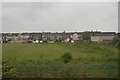
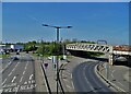
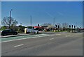
DN5 9TU is a small residential postcode area in England, home to around 1,428 people. It is a compact cluster of properties, predominantly houses, catering to a community of adults aged 30–64, with a median age of 47. The area lacks significant natural or environmental constraints, such as flood zones, protected woodlands, or Areas of Outstanding Natural Beauty. This makes it a straightforward place to live, though it carries a high crime risk. Residents benefit from strong digital connectivity, with near-perfect broadband scores, and practical transport links, including multiple nearby railway stations. The area’s small size means it is likely tightly knit, with daily life shaped by proximity to retail hubs like Morrisons and Iceland, and regular rail access to Doncaster and surrounding towns. While the population is predominantly White, the community’s character is defined by its mix of owner-occupied homes and local amenities. For buyers, it offers a straightforward, no-frills living environment, though safety considerations should be weighed carefully.
- Area Type
- Postcode
- Area Size
- Not available
- Population
- 1428
- Population Density
- 2754 people/km²
The property market in DN5 9TU is dominated by houses, with 45% of residents owning their homes. This suggests a mix of owner-occupied and rental properties, though the small population size means the market is limited in scale. The area’s housing stock is likely to be older, given the median age of residents and the prevalence of traditional homes. Buyers should note that the area is not a hotspot for investment or new developments, as it lacks planning constraints or natural attractions. Proximity to rail stations like Bentley and Doncaster may appeal to commuters, but the high crime risk could deter some. For those seeking a quiet, low-traffic residential area with straightforward housing options, DN5 9TU offers a no-nonsense alternative, though its small size means competition for properties is likely minimal.
House Prices in DN5 9TU
No properties found in this postcode.
Energy Efficiency in DN5 9TU
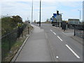
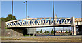
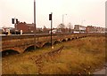
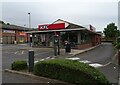
Daily life in DN5 9TU is shaped by its proximity to retail and transport hubs. Residents have access to five retail outlets, including Morrisons York, Iceland Doncaster, and Morrisons Daily Doncaster, offering a range of shopping options within practical reach. The area’s rail network, with stations like Bentley and Doncaster, provides convenient links to nearby towns, enhancing mobility for commuters and shoppers. While there is no mention of parks or leisure facilities in the data, the absence of natural constraints like protected woodlands or wetlands suggests a straightforward, functional lifestyle. The community’s character is defined by its small size and reliance on nearby amenities, making it suitable for those who value convenience and simplicity over sprawling urban or rural environments.
Amenities
Schools
| Rank | School | Type | Entry gender | Ages |
|---|
Explore more schools in this area
Go to Schools tabDemographics
The population of DN5 9TU is 1,428, with a median age of 47. The majority of residents fall within the 30–64 age range, indicating a mature, stable community. Home ownership stands at 45%, suggesting a balance between owner-occupied properties and rental stock. The area is characterised by houses rather than flats, reflecting a traditional housing stock. The predominant ethnic group is White, though specific data on diversity or deprivation is not provided. The age profile implies a community likely focused on family life or established careers, with fewer young families or retirees compared to other areas. The absence of detailed deprivation data means it is unclear how socioeconomic factors might influence quality of life, but the high crime risk score of 0/100 highlights a pressing concern for residents.
Household Size
Accommodation Type
Tenure
Ethnic Group
Religion
Household Composition
Age
Household Deprivation
NS-SEC
Explore more demographic insights in this area
Go to Demographics tabPlanning
Planning Constraints
- Flood RiskPremium
- Ramsar Wetland SitesPremium
- Area of Outstanding Natural BeautyPremium
- Protected Nature ReservePremium
- Protected WoodlandPremium