Area Overview for DN5 9PX
Photos of DN5 9PX
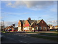
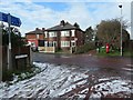
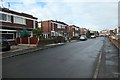
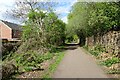
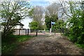
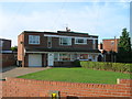


18 photos from this area
Area Information
Key information about the DN5 9PX including its size, population, and administrative classification.
- Area Type
- Postcode
- Area Size
- 7.2 hectares
- Population
- 1458
- Population Density
- 2825 people/km²
House Prices in DN5 9PX
81
Properties
£160,299
Average Sold Price
£40,000
Lowest Price
£242,500
Highest Price
Showing 81 properties
| Address | Type | Beds | Baths | Last Sale Price | Last Sale Date | |
|---|---|---|---|---|---|---|
| 146 Dominion Road, Scawthorpe, Doncaster, DN5 9PX | Detached | 3 | 2 | £180,000 | Aug 2025 | |
| 148 Dominion Road, Scawthorpe, Doncaster, DN5 9PX | Detached | 3 | 2 | £170,000 | Jul 2025 | |
| 160 Dominion Road, Scawthorpe, Doncaster, DN5 9PX | Detached | 4 | 2 | £200,000 | Jun 2025 | |
| 28 Dominion Road, Scawthorpe, Doncaster, DN5 9PX | Semi-detached | 3 | 3 | £160,000 | May 2025 | |
| 156 Dominion Road, Scawthorpe, Doncaster, DN5 9PX | Detached | 3 | 2 | £199,950 | Apr 2025 | |
| 62 Dominion Road, Scawthorpe, Doncaster, DN5 9PX | Detached | 3 | 2 | £230,000 | Dec 2023 | |
| 16 Dominion Road, Scawthorpe, Doncaster, DN5 9PX | Semi-detached | 3 | 2 | £193,000 | Dec 2023 | |
| 112 Dominion Road, Scawthorpe, Doncaster, DN5 9PX | Terraced | 2 | 1 | £144,000 | Jul 2023 | |
| 144 Dominion Road, Scawthorpe, Doncaster, DN5 9PX | Semi-detached | 2 | 1 | £145,000 | Jul 2022 | |
| 4 Dominion Road, Scawthorpe, Doncaster, DN5 9PX | house | - | - | £40,000 | Jan 2022 |
Page 1 of 9
Energy Efficiency in DN5 9PX
Amenities
Schools
| Rank | School | Type | Entry gender | Ages |
|---|
Explore more schools in this area
Go to Schools tabDemographics
Household Size
One person
most common
Accommodation Type
Houses
most common
Tenure
65
majority
Ethnic Group
White
most common
Religion
N/A
most common
Household Composition
N/A
most common
Age
47
median
Adults (30-64 years)
most common
Household Deprivation
N/A
with no deprivation
NS-SEC
19
in Lower managerial occupations
Explore more demographic insights in this area
Go to Demographics tabPlanning
Planning Constraints
- Flood RiskPremium
- Ramsar Wetland SitesPremium
- Area of Outstanding Natural BeautyPremium
- Protected Nature ReservePremium
- Protected WoodlandPremium