Area Overview for DN5 8SP
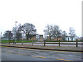
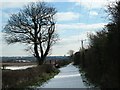
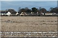
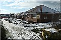
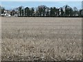
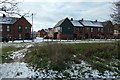
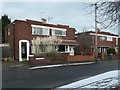
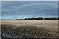
Photos of DN5 8SP


Area Information
DN5 8SP is a compact residential postcode in England, covering just 1981 square metres and home to 1630 residents. With a population density of 1281 people per square kilometre, it is a tightly knit community where daily life revolves around close-knit interactions and local amenities. The area’s small size means residents have easy access to nearby shops, schools, and transport links, fostering a sense of familiarity. The median age of 47 suggests a mature population, with the majority aged between 30 and 64, creating a stable environment where families and long-term residents coexist. Most homes are owner-occupied, with 72% of properties in private hands, reflecting a community rooted in permanence. While the area lacks sprawling landscapes, its proximity to railway stations and retail hubs like Aldi Scawthorpe and Asda Sun ensures practicality for everyday needs. Living here means prioritising convenience over vast open spaces, with a focus on accessibility and community cohesion.
- Area Type
- Postcode
- Area Size
- 1981 m²
- Population
- 1630
- Population Density
- 1281 people/km²
DN5 8SP is primarily an owner-occupied area, with 72% of properties in private hands. This contrasts with rental markets, where buy-to-let or private rentals dominate. The accommodation type is almost exclusively houses, meaning the area lacks apartments or flats, which may appeal to buyers seeking traditional family homes. Given the postcode’s small size—just 1981 square metres—the housing stock is limited, making it a niche market for those prioritising proximity to local amenities over larger plots. The high home ownership rate suggests a long-term commitment from residents, potentially leading to a stable property market with predictable values. However, the small area means buyers must consider the immediate surroundings for additional housing options. For those seeking a quiet, established residential environment with easy access to schools and transport, DN5 8SP offers a focused, compact alternative to sprawling suburbs.
House Prices in DN5 8SP
Showing 5 properties
| Address | Type | Beds | Baths | Last Sale Price | Last Sale Date | |
|---|---|---|---|---|---|---|
| 35 Malton Road, Scawsby, Doncaster, DN5 8SP | Semi-detached | 3 | 1 | £103,000 | Oct 2015 | |
| 37 Malton Road, Scawsby, Doncaster, DN5 8SP | Semi-detached | 3 | - | £99,950 | Sep 2013 | |
| 39 Malton Road, Scawsby, Doncaster, DN5 8SP | house | 3 | - | £113,000 | May 2011 | |
| 41 Malton Road, Scawsby, Doncaster, DN5 8SP | house | - | - | £128,500 | Nov 2007 | |
| 43 Malton Road, Scawsby, Doncaster, DN5 8SP | Semi-detached | 3 | 1 | - | - |
Energy Efficiency in DN5 8SP
Residents of DN5 8SP benefit from nearby retail outlets such as Aldi Scawthorpe, Asda Sun, and Tesco Barnsley, providing essential shopping within practical reach. The area’s rail connectivity, with stations at Bentley, Doncaster, and Adwick, enhances mobility for commuting or leisure travel. While the data does not specify parks or recreational facilities, the high population density suggests a focus on compact living rather than expansive green spaces. The presence of multiple schools and shops creates a self-contained environment, reducing the need for long journeys. However, the small area means amenities are concentrated, which can be both a convenience and a limitation. For those valuing proximity to services and a tightly woven community, DN5 8SP offers a lifestyle centred on accessibility and practicality, though it may lack the sprawling amenities of larger towns.
Amenities
Schools
Residents of DN5 8SP have access to a range of school types, including primary, special needs, and academy institutions. Ridgewood School serves as both a primary and academy school, with an Ofsted rating of ‘good’, offering a structured educational option for local families. Anchorage School and Stone Hill School are special needs institutions, providing tailored support for students with specific requirements. Rosedale Road First School, classified as ‘other’, likely caters to early-years education or alternative learning models. The mix of school types ensures families can choose between mainstream education and specialist support, though the absence of secondary schools may require commuting. The presence of multiple options, including a rated academy, suggests a commitment to educational diversity, though parents should consider the need for additional resources beyond primary levels.
| Rank | School | Type | Entry gender | Ages |
|---|
Explore more schools in this area
Go to Schools tabDemographics
The population of DN5 8SP skews towards adults aged 30 to 64, with a median age of 47. This suggests a community of established professionals and families, rather than a mix of younger or older demographics. Home ownership is high, with 72% of residents living in properties they own, compared to 28% renting. The accommodation type is predominantly houses, indicating a lack of high-density housing or flats. The predominant ethnic group is White, reflecting a homogenous demographic profile. With a population density of 1281 people per square kilometre, the area is densely populated, which can influence local services and social dynamics. While this density may mean limited private green space, it also ensures proximity to amenities and a strong sense of community. The data does not indicate significant deprivation, but the high ownership rate and age profile suggest a stable, middle-income environment.
Household Size
Accommodation Type
Tenure
Ethnic Group
Religion
Household Composition
Age
Household Deprivation
NS-SEC
Explore more demographic insights in this area
Go to Demographics tabPlanning
Planning Constraints
- Flood RiskPremium
- Ramsar Wetland SitesPremium
- Area of Outstanding Natural BeautyPremium
- Protected Nature ReservePremium
- Protected WoodlandPremium