Area Overview for DN5 8AY
Photos of DN5 8AY


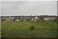
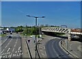
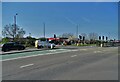

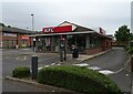
38 photos from this area
Area Information
Key information about the DN5 8AY including its size, population, and administrative classification.
- Area Type
- Postcode
- Area Size
- 4.5 hectares
- Population
- 1532
- Population Density
- 1845 people/km²
House Prices in DN5 8AY
74
Properties
£123,284
Average Sold Price
£24,500
Lowest Price
£420,000
Highest Price
Showing 74 properties
| Address | Type | Beds | Baths | Last Sale Price | Last Sale Date | |
|---|---|---|---|---|---|---|
| Arleigh, Northfield Road, Sprotbrough, Doncaster, DN5 8AY | Detached | 2 | 1 | £210,000 | Feb 2025 | |
| 96 Northfield Road, Sprotbrough, Doncaster, DN5 8AY | Semi-detached | 2 | 1 | £117,500 | Jan 2025 | |
| 100 Northfield Road, Sprotbrough, Doncaster, DN5 8AY | Semi-detached | 3 | 1 | £110,000 | May 2024 | |
| 23 Northfield Road, Sprotbrough, Doncaster, DN5 8AY | Semi-detached | 4 | 2 | £250,000 | Jan 2023 | |
| 68 Northfield Road, Sprotbrough, Doncaster, DN5 8AY | Semi-detached | 3 | 1 | £205,000 | Nov 2022 | |
| 12 Northfield Road, Sprotbrough, Doncaster, DN5 8AY | Semi-detached | 3 | 1 | £184,000 | Mar 2022 | |
| 61 Northfield Road, Sprotbrough, Doncaster, DN5 8AY | house | - | - | £90,000 | Aug 2021 | |
| 1 Northfield Road, Sprotbrough, Doncaster, DN5 8AY | Detached | 2 | 1 | £145,000 | Jun 2021 | |
| 8 Northfield Road, Sprotbrough, Doncaster, DN5 8AY | house | 2 | 1 | £129,999 | Nov 2020 | |
| 5 Northfield Road, Sprotbrough, Doncaster, DN5 8AY | house | 3 | - | £178,000 | Oct 2020 |
Page 1 of 8
Energy Efficiency in DN5 8AY
Amenities
Schools
| Rank | School | Type | Entry gender | Ages |
|---|
Explore more schools in this area
Go to Schools tabDemographics
Household Size
Two person
most common
Accommodation Type
Houses
most common
Tenure
72
majority
Ethnic Group
White
most common
Religion
N/A
most common
Household Composition
N/A
most common
Age
47
median
Adults (30-64 years)
most common
Household Deprivation
N/A
with no deprivation
NS-SEC
26
in Lower managerial occupations
Explore more demographic insights in this area
Go to Demographics tabPlanning
Planning Constraints
- Flood RiskPremium
- Ramsar Wetland SitesPremium
- Area of Outstanding Natural BeautyPremium
- Protected Nature ReservePremium
- Protected WoodlandPremium