Area Overview for DN5 7WW
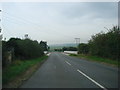
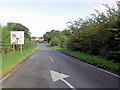
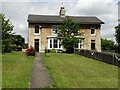
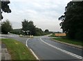
Photos of DN5 7WW


Area Information
Living in DN5 7WW offers a quiet, low-density lifestyle typical of small residential clusters in England. With a population of 1604 spread across 39 people per square kilometre, the area feels uncluttered, making it ideal for those seeking a peaceful environment without the pressures of urban density. This postcode is part of a broader network of nearby villages and towns, offering a balance between seclusion and access to essential services. Residents benefit from proximity to primary schools, rail stations, and local shops, ensuring daily needs are met without long commutes. The area’s character is defined by its modest scale—houses outnumber flats, and the community is likely to be tight-knit, given the median age of 47 and the predominance of adult households. While not a bustling hub, DN5 7WW provides a stable base for families and professionals looking for a manageable pace of life, with the flexibility to explore nearby amenities or work remotely, supported by decent digital connectivity.
- Area Type
- Postcode
- Area Size
- Not available
- Population
- 1604
- Population Density
- 39 people/km²
The property market in DN5 7WW is characterised by a 49% home ownership rate, with houses making up the majority of accommodation types. This suggests a predominantly owner-occupied area, though the remaining 51% of properties are likely rented, possibly by younger or transient residents. The focus on houses rather than flats or apartments indicates a market that may appeal to families seeking space and privacy. Given the small size of the postcode, the housing stock is limited, meaning buyers may need to consider nearby areas for a broader selection. The low population density of 39 people per square kilometre also implies that properties are spread out, potentially offering larger gardens or outdoor space. For those prioritising stability, the area’s modest scale and traditional housing stock could provide a reliable foundation for investment or long-term residence.
House Prices in DN5 7WW
No properties found in this postcode.
Energy Efficiency in DN5 7WW
The lifestyle in DN5 7WW is shaped by its proximity to essential amenities. Local retail options include Co-op Woodlands, Heron Adwick, and Budgens Freshos, providing access to groceries and everyday shopping. The area’s rail stations—Adwick, Bentley, and South Elmsall—offer connections to nearby towns, enhancing mobility for work or leisure. While the data does not mention parks or leisure facilities, the presence of multiple retail and transport hubs suggests a practical, no-frills approach to daily life. The modest scale of the postcode means amenities are concentrated, reducing the need for long journeys. For residents, this balance of convenience and quiet living could appeal to those valuing simplicity, with the ability to access services without the sprawl of larger towns.
Amenities
Schools
Residents of DN5 7WW have access to several primary schools within practical reach. These include Scawsby Rosedale Primary School, Brodsworth CofE First and Middle School, and Rosedale Primary School, which holds a ‘good’ Ofsted rating. Hooton Pagnell All Saints Church of England Primary School appears twice in the data, also with a ‘good’ rating. The presence of multiple primary schools suggests a well-served educational environment for young families, though secondary education options are not listed. The mix of Church of England and state-run schools provides diversity in educational approaches, allowing parents to choose between faith-based and secular institutions. For buyers prioritising schools, the proximity to these rated institutions could be a key consideration, especially for families with children starting primary education.
| Rank | School | Type | Entry gender | Ages |
|---|
Explore more schools in this area
Go to Schools tabDemographics
The community in DN5 7WW is predominantly composed of adults aged 30–64, with a median age of 47. This suggests a mature population, likely with established careers and families. Home ownership stands at 49%, indicating a mix of owner-occupied properties and rental homes, though the exact proportion of renters is not specified. The accommodation type is largely houses, reflecting a traditional, low-rise residential profile. The predominant ethnic group is White, though no further breakdown of diversity is provided. The data does not include deprivation metrics, but the moderate population size and age distribution suggest a community focused on stability rather than rapid change. For buyers, this demographic profile implies a market where properties may cater to long-term residents rather than transient populations, with potential for family-oriented homes.
Household Size
Accommodation Type
Tenure
Ethnic Group
Religion
Household Composition
Age
Household Deprivation
NS-SEC
Explore more demographic insights in this area
Go to Demographics tabPlanning
Planning Constraints
- Flood RiskPremium
- Ramsar Wetland SitesPremium
- Area of Outstanding Natural BeautyPremium
- Protected Nature ReservePremium
- Protected WoodlandPremium