Area Overview for DN5 7UU
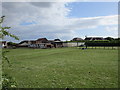
Photos of DN5 7UU
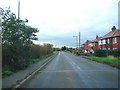
![40 mph on Green Lane [B6422] in DN5 7UU](https://images.propbar.co.uk/images/geograph/60/52/6052187_120.jpg)
Area Information
Living in DN5 7UU offers a quiet, low-density lifestyle in a small residential cluster. With a population of 1,604 and a density of 39 people per square kilometre, the area feels uncluttered, ideal for those seeking space without isolation. The community is predominantly composed of adults aged 30–64, suggesting a mix of families and older professionals. Daily life is shaped by proximity to local amenities, including five retail outlets like Heron Adwick and Co-op Woodlands, and accessible rail links such as Adwick and Bentley stations. The area’s modest size means residents can easily navigate nearby services, while the presence of multiple primary schools ensures families have educational options. Though small, DN5 7UU balances practicality with a sense of calm, making it appealing to those prioritising convenience and a slower pace of life.
- Area Type
- Postcode
- Area Size
- Not available
- Population
- 1604
- Population Density
- 39 people/km²
The property market in DN5 7UU is characterised by a 49% home ownership rate, meaning nearly half of properties are owner-occupied, while the remainder are likely rented or held under other tenures. The accommodation type is predominantly houses, suggesting a lack of high-density housing such as apartments or flats. This makes the area more suited to families or individuals seeking larger, more private homes. Given the small size of the postcode and its low population density, the housing stock is limited, which may mean fewer options for buyers but potentially more characterful properties. Proximity to rail links and schools could enhance the area’s appeal, though the small size means buyers should consider nearby areas for broader choices.
House Prices in DN5 7UU
No properties found in this postcode.
Energy Efficiency in DN5 7UU
The lifestyle in DN5 7UU is shaped by its modest amenities and proximity to essential services. Retail options include five local outlets such as Heron Adwick and Co-op Woodlands, offering basic shopping needs. The area’s rail stations, including Adwick and Bentley, provide access to broader regional networks, enhancing connectivity for commuters. While there is no mention of parks or leisure facilities in the data, the low population density suggests a quieter, less crowded environment. The presence of multiple schools and retail outlets indicates a focus on practicality, making daily life convenient for families and individuals seeking a balanced, low-stress lifestyle.
Amenities
Schools
Residents of DN5 7UU have access to several primary schools, including Scawsby Rosedale Primary School, Brodsworth CofE First and Middle School, and Rosedale Primary School, which holds a ‘good’ Ofsted rating. Hooton Pagnell All Saints Church of England Primary School also appears twice in the data, both with ‘good’ ratings. The concentration of primary schools suggests a family-friendly environment, though no secondary schools are listed. The presence of multiple schools, particularly those with positive Ofsted ratings, provides parents with choices in education quality and approach. However, the lack of secondary schooling may require families to consider commuting options for older children.
| Rank | School | Type | Entry gender | Ages |
|---|
Explore more schools in this area
Go to Schools tabDemographics
DN5 7UU has a median age of 47, with the majority of residents aged 30–64. This suggests a community of established professionals and families, rather than a younger or elderly demographic. Home ownership stands at 49%, indicating a mix of owner-occupied and rental properties. The area is predominantly composed of houses, reflecting a traditional housing stock rather than flats or apartments. The predominant ethnic group is White, which aligns with broader regional trends. While no specific deprivation data is provided, the age profile and housing type imply a stable, middle-income community. The relatively low population density of 39 people per square kilometre further supports a lifestyle focused on privacy and space rather than urban density.
Household Size
Accommodation Type
Tenure
Ethnic Group
Religion
Household Composition
Age
Household Deprivation
NS-SEC
Explore more demographic insights in this area
Go to Demographics tabPlanning
Planning Constraints
- Flood RiskPremium
- Ramsar Wetland SitesPremium
- Area of Outstanding Natural BeautyPremium
- Protected Nature ReservePremium
- Protected WoodlandPremium