Area Overview for DN5 7BX
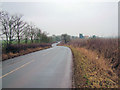
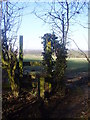
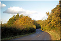
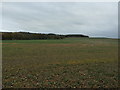
Photos of DN5 7BX
Area Information
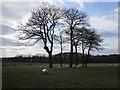
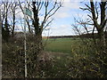
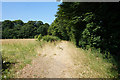
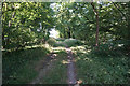
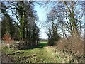
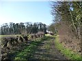
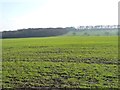
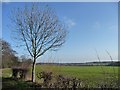
DN5 7BX is a small, tightly knit residential area in England, covering just 1.5 km² with a population of 1604. Its low population density of 39 people per square kilometre suggests a quiet, less crowded environment, ideal for those seeking a peaceful living space. The area is characterised by a predominance of houses, reflecting a community that values traditional, family-oriented living. With a median age of 47, the population skews towards adults aged 30–64, indicating a stable demographic with established households. Residents benefit from proximity to several primary schools, including Rosedale Primary School and Hooton Pagnell All Saints Church of England Primary School, both rated ‘good’ by Ofsted. The area’s compact size means amenities are within practical reach, though it remains a niche postcode with limited commercial or industrial development. For buyers, DN5 7BX offers a blend of residential tranquillity and access to nearby services, though its small footprint means it is best suited to those prioritising a close-knit community over sprawling urban convenience.
- Area Type
- Postcode
- Area Size
- 1.5 km²
- Population
- 1604
- Population Density
- 39 people/km²
The property market in DN5 7BX is defined by a 49% home ownership rate, indicating that nearly half of the properties are owner-occupied, while the remainder are likely rentals. The accommodation type is predominantly houses, suggesting a market skewed towards single-family homes rather than apartments or terraced housing. This aligns with the area’s low population density and residential character. For buyers, the small size of the postcode—just 1.5 km²—means the housing stock is limited, and the immediate surroundings may offer more options. The predominance of houses may appeal to families or those seeking larger living spaces, though the market’s niche nature could mean fewer choices compared to larger urban areas. Potential buyers should consider the area’s compact size and the need to look beyond DN5 7BX for broader property availability.
House Prices in DN5 7BX
Showing 1 properties
| Address | Type | Beds | Baths | Last Sale Price | Last Sale Date | |
|---|---|---|---|---|---|---|
| Frickley Lodge Farm, Clayton Lane, Hooton Pagnell, Doncaster, DN5 7BX | Semi-detached | - | - | - | - |
Energy Efficiency in DN5 7BX
Daily life in DN5 7BX revolves around its small-scale amenities and nearby services. The area’s proximity to five railway stations, including Thurnscoe and Goldthorpe, offers easy access to commuting routes and regional travel. Retail options are limited but practical, with Asda Thurnscoe, Asda Goldthorpe, and Spar providing essentials like groceries and household items. While there are no major leisure or entertainment venues listed, the area’s quiet, residential character suggests a focus on local, community-based activities. The presence of multiple primary schools and low population density implies a slower pace of life, with opportunities for outdoor activities in nearby green spaces, though specific parks or recreational facilities are not detailed in the data. For those seeking convenience without urban sprawl, DN5 7BX offers a simple, functional lifestyle with access to basic services and transport links.
Amenities
Schools
Residents of DN5 7BX have access to several primary schools, including Scawsby Rosedale Primary School, Hooton Pagnell All Saints Church of England Primary School, Brodsworth CofE First and Middle School, and Rosedale Primary School, which holds an Ofsted rating of ‘good’. Two of these schools—Hooton Pagnell All Saints Church of England Primary School and Rosedale Primary School—explicitly state their Ofsted ratings, providing assurance for families prioritising quality education. The presence of multiple primary schools suggests a well-served area for younger children, though no secondary schools are listed in the data. This means families may need to look further afield for secondary education. The mix of Church of England and state-funded schools offers variety in educational approaches, though the absence of secondary options is a practical consideration for long-term family planning.
| Rank | School | Type | Entry gender | Ages |
|---|
Explore more schools in this area
Go to Schools tabDemographics
The community in DN5 7BX is predominantly composed of adults aged 30–64, with a median age of 47. This suggests a population of largely established households, many of whom may be retired or in their middle years of employment. Home ownership stands at 49%, indicating a mix of owner-occupied properties and rental units. The accommodation type is primarily houses, reflecting a preference for single-family homes over flats or apartments. The predominant ethnic group is White, though no specific data on diversity or deprivation is provided. The low population density of 39 people per km² implies a spread-out, possibly rural or semi-rural setting, which may influence the area’s character and pace of life. For those considering DN5 7BX, the demographic profile suggests a mature, stable community with a focus on long-term residency rather than transient populations.
Household Size
Accommodation Type
Tenure
Ethnic Group
Religion
Household Composition
Age
Household Deprivation
NS-SEC
Explore more demographic insights in this area
Go to Demographics tabPlanning
Planning Constraints
- Flood RiskPremium
- Ramsar Wetland SitesPremium
- Area of Outstanding Natural BeautyPremium
- Protected Nature ReservePremium
- Protected WoodlandPremium