Area Overview for DN41 8AX
Photos of DN41 8AX
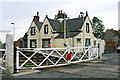
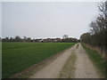
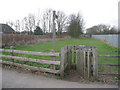
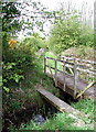
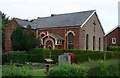
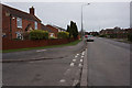
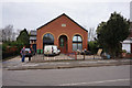
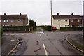
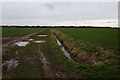

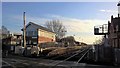
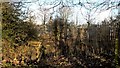
38 photos from this area
Area Information
Key information about the DN41 8AX including its size, population, and administrative classification.
- Area Type
- Postcode
- Area Size
- 9242 m²
- Population
- 1324
- Population Density
- 72 people/km²
House Prices in DN41 8AX
19
Properties
£118,188
Average Sold Price
£40,000
Lowest Price
£248,000
Highest Price
Showing 19 properties
| Address | Type | Beds | Baths | Last Sale Price | Last Sale Date | |
|---|---|---|---|---|---|---|
| 32 Station Road, Stallingborough, DN41 8AX | house | 3 | 1 | £200,000 | Aug 2025 | |
| Bestwood, 50 Station Road, Stallingborough, DN41 8AX | Detached | 4 | 2 | £248,000 | Aug 2025 | |
| 52 Station Road, Stallingborough, DN41 8AX | Bungalow | 2 | 1 | £148,000 | Feb 2019 | |
| 26 Station Road, Stallingborough, DN41 8AX | Bungalow | 2 | - | £102,000 | Aug 2015 | |
| Vandora, 24 Station Road, Stallingborough, DN41 8AX | Bungalow | 3 | - | £122,000 | Sep 2012 | |
| Oakwell, 36 Station Road, Stallingborough, DN41 8AX | house | 3 | - | £40,000 | Oct 2001 | |
| 54 Station Road, Stallingborough, DN41 8AX | Bungalow | - | - | £41,500 | Nov 1997 | |
| 28 Station Road, Stallingborough, DN41 8AX | Bungalow | - | - | £44,000 | Dec 1996 | |
| 44 Station Road, Stallingborough, DN41 8AX | Bungalow | 3 | 1 | - | - | |
| Joss, 22 Station Road, Stallingborough, DN41 8AX | Bungalow | 3 | - | - | - |
Page 1 of 2
Energy Efficiency in DN41 8AX
Amenities
Schools
| Rank | School | Type | Entry gender | Ages |
|---|
Explore more schools in this area
Go to Schools tabDemographics
Household Size
Two person
most common
Accommodation Type
Houses
most common
Tenure
79
majority
Ethnic Group
White
most common
Religion
N/A
most common
Household Composition
N/A
most common
Age
47
median
Adults (30-64 years)
most common
Household Deprivation
N/A
with no deprivation
NS-SEC
29
in Lower managerial occupations
Explore more demographic insights in this area
Go to Demographics tabPlanning
Planning Constraints
- Flood RiskPremium
- Ramsar Wetland SitesPremium
- Area of Outstanding Natural BeautyPremium
- Protected Nature ReservePremium
- Protected WoodlandPremium