Area Overview for DN40 9AU
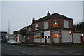
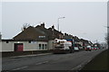
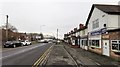
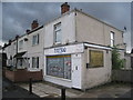
Photos of DN40 9AU


Area Information
DN40 9AU is a small residential cluster in England, home to 1,521 people spread across a compact area with a population density of 212 people per square kilometre. This is a tight-knit community where daily life is shaped by proximity to essential services and a modest, stable population. The area’s character is defined by its balance of practical living and accessible amenities. Residents benefit from nearby rail links, including Stallingborough and Habrough stations, which connect to broader regional networks. While the area is not densely populated, its small size means neighbours are likely to be familiar faces. The median age of 47 suggests a mature demographic, with a strong presence of adults aged 30–64. This reflects a community rooted in stability, with families and professionals coexisting in a setting that prioritises convenience over urban sprawl. However, the area’s crime risk is above average, a factor prospective buyers should consider alongside its strong broadband connectivity and low flood risk.
- Area Type
- Postcode
- Area Size
- Not available
- Population
- 1521
- Population Density
- 212 people/km²
The property market in DN40 9AU is characterised by a low home ownership rate of 34%, with houses making up the predominant accommodation type. This suggests a market where rental properties may outnumber owner-occupied homes, though the small size of the area means housing stock is limited. The presence of standalone houses indicates a focus on family-friendly or semi-detached living, which may appeal to buyers seeking space and privacy. However, the low home ownership percentage could signal a reliance on private rentals, potentially affecting long-term investment value. Given the area’s compact nature, property choices are likely restricted to a few key locations. Buyers should consider the balance between available housing types and the community’s demographic profile, which skews towards middle-aged adults. The market may be more suited to those prioritising proximity to amenities over property diversity.
House Prices in DN40 9AU
No properties found in this postcode.
Energy Efficiency in DN40 9AU
Living in DN40 9AU offers access to practical amenities within easy reach. The area’s retail options include Aldi, Farmfoods, and Tesco in Immingham, providing essential shopping for groceries and household items. These stores are likely within a short drive or walk, supporting daily errands without the need for long commutes. The rail network, with stations like Stallingborough and Habrough, adds convenience for travel to nearby towns, while the absence of larger leisure or entertainment venues means residents may need to venture further for dining or cultural activities. The area’s compact nature ensures a quiet, low-traffic environment, though it lacks dedicated parks or recreational spaces. For those prioritising convenience over sprawling amenities, DN40 9AU’s proximity to retail and transport hubs offers a functional lifestyle.
Amenities
Schools
| Rank | School | Type | Entry gender | Ages |
|---|
Explore more schools in this area
Go to Schools tabDemographics
The community in DN40 9AU is predominantly composed of adults aged 30–64, with a median age of 47. This suggests a population skewed towards middle-aged individuals, likely including families and established professionals. Home ownership is relatively low at 34%, indicating a mix of renters and owner-occupiers. The area’s accommodation is primarily houses, reflecting a preference for standalone properties over flats or apartments. The predominant ethnic group is White, with no specific data provided on other demographics. The population density of 212 people per square kilometre means the area is neither crowded nor sparse, offering a balance between seclusion and accessibility. While 34% home ownership may imply a rental market, the small size of the area means housing stock is limited, potentially affecting availability for buyers. The age profile suggests a community with a strong focus on long-term stability, though the lack of younger residents may impact local schools and services.
Household Size
Accommodation Type
Tenure
Ethnic Group
Religion
Household Composition
Age
Household Deprivation
NS-SEC
Explore more demographic insights in this area
Go to Demographics tabPlanning
Planning Constraints
- Flood RiskPremium
- Ramsar Wetland SitesPremium
- Area of Outstanding Natural BeautyPremium
- Protected Nature ReservePremium
- Protected WoodlandPremium