Area Overview for DN40 3JY
Photos of DN40 3JY
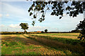
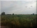
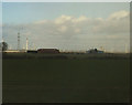
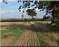
7 photos from this area
Area Information
Key information about the DN40 3JY including its size, population, and administrative classification.
- Area Type
- Postcode
- Area Size
- 2.4 km²
- Population
- 1837
- Population Density
- 75 people/km²
House Prices in DN40 3JY
8
Properties
£325,000
Average Sold Price
£325,000
Lowest Price
£325,000
Highest Price
Showing 8 properties
| Address | Type | Beds | Baths | Last Sale Price | Last Sale Date | |
|---|---|---|---|---|---|---|
| Low Farm Cottage, Access Roads In Disused Airfield, North Killingholme, DN40 3JY | Detached | 5 | 4 | £325,000 | Feb 2019 | |
| Longlakes Farm, Access Roads In Disused Airfield, North Killingholme, DN40 3JY | Bungalow | 8 | - | - | - | |
| Gas Valve Compound, Access Track In Disused Airfield, North Killingholme, DN40 3JY | commercial | - | - | - | - | |
| Western Length Of Perimeter Track, Access Roads In Disused Airfield, North Killingholme, DN40 3JY | commercial | - | - | - | - | |
| B Site, Access Roads In Disused Airfield, North Killingholme, DN40 3JY | Bungalow | - | - | - | - | |
| A Site, Access Roads In Disused Airfield, North Killingholme, DN40 3JY | Bungalow | - | - | - | - | |
| Green Park Farm, Access Roads In Disused Airfield, North Killingholme, DN40 3JY | Bungalow | - | - | - | - | |
| D Site, Crook Mill Road, East Halton, DN40 3JY | Bungalow | - | - | - | - |
Energy Efficiency in DN40 3JY
Amenities
Schools
| Rank | School | Type | Entry gender | Ages |
|---|
Explore more schools in this area
Go to Schools tabDemographics
Household Size
Two person
most common
Accommodation Type
Houses
most common
Tenure
68
majority
Ethnic Group
White
most common
Religion
N/A
most common
Household Composition
N/A
most common
Age
47
median
Adults (30-64 years)
most common
Household Deprivation
N/A
with no deprivation
NS-SEC
20
in Lower managerial occupations
Explore more demographic insights in this area
Go to Demographics tabPlanning
Planning Constraints
- Flood RiskPremium
- Ramsar Wetland SitesPremium
- Area of Outstanding Natural BeautyPremium
- Protected Nature ReservePremium
- Protected WoodlandPremium