Area Overview for DN40 2YA
Photos of DN40 2YA


Area Information
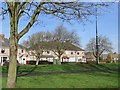
DN40 2YA is a small, tightly knit residential postcode in England, home to 1,394 residents. The area’s compact size means it feels intimate, with a focus on local amenities and community ties. Most residents are adults aged 30–64, reflecting a mature demographic that likely values stability and proximity to essential services. The area is predominantly composed of houses, with 39% of properties owner-occupied, suggesting a mix of long-term residents and renters. Daily life here is shaped by its location, with nearby schools, railway stations, and retail hubs within practical reach. The broadband score of 97 ensures reliable internet connectivity, supporting remote work or online learning, while the mobile coverage of 85 is good but not exceptional. Despite its small footprint, DN40 2YA offers a balance of convenience and accessibility, though the area’s crime risk is a notable concern for potential buyers. Its proximity to Humberside Airport and multiple railway stations also makes it a viable option for commuters or those seeking transport links to larger cities.
- Area Type
- Postcode
- Area Size
- Not available
- Population
- 1394
- Population Density
- 3531 people/km²
The property market in DN40 2YA is characterised by a focus on houses, with 39% of properties owner-occupied. This suggests a mix of long-term residents and a rental market, though the small size of the area means the housing stock is limited. The predominance of houses over flats or apartments may appeal to families or those seeking more space, but the low number of properties also means competition could be fierce for buyers. Given the area’s proximity to schools and transport links, it may attract those prioritising convenience over size. However, the high crime risk score could influence property values or desirability, depending on buyer priorities. For those considering the area, it’s worth noting that the immediate surroundings likely offer similar housing options, though the exact range of property types or prices is not specified in the data.
House Prices in DN40 2YA
No properties found in this postcode.
Energy Efficiency in DN40 2YA
Residents of DN40 2YA have access to a range of local amenities, including five retail outlets such as Heron Immingham, Tesco Immingham, and Farmfoods Immingham. These provide essential shopping and services, reducing the need for long trips to larger towns. The railway stations within the area also offer convenience for travel, whether for commuting or visiting nearby attractions. While the data does not specify dining or leisure venues, the presence of multiple retail options suggests a functional, community-focused lifestyle. The area’s proximity to Humberside Airport may also make it a hub for regional travel or business. For daily life, the combination of retail, transport, and nearby schools creates a practical environment, though the absence of detailed information on parks or leisure facilities means the full extent of recreational opportunities remains unclear.
Amenities
Schools
Residents of DN40 2YA have access to several primary schools within the vicinity, including Pelham Infants’ School, Allerton Infants’ School, Allerton Junior School, Immingham St Andrew’s CofE Junior School, and Allerton Primary School. These institutions cater to younger children, with a mix of state and church-affiliated options. The presence of multiple primary schools suggests a strong focus on education in the area, though no secondary schools are listed. Families with young children may benefit from the proximity of these schools, though the absence of Ofsted ratings or performance data means it’s unclear how they compare nationally. The concentration of primary schools also indicates that the area is likely to have a significant number of young families, aligning with the demographic of adults aged 30–64.
| Rank | School | Type | Entry gender | Ages |
|---|
Explore more schools in this area
Go to Schools tabDemographics
The population of DN40 2YA skews towards adults aged 30–64, with a median age of 47. This suggests a community of established professionals and families, rather than a younger or elderly demographic. Home ownership stands at 39%, indicating that nearly two-thirds of properties are rented, which may reflect the area’s small size and limited housing stock. The accommodation type is primarily houses, which are more common than flats or apartments. The predominant ethnic group is White, though no specific data on diversity or deprivation is provided. The age profile implies a stable, long-term resident base, but the relatively high proportion of renters could suggest a transient element. For quality of life, the absence of planning constraints like protected woodlands or AONB areas may make development less restricted, though the high crime risk score of 27 (on a 100-point scale) raises practical concerns for safety and security.
Household Size
Accommodation Type
Tenure
Ethnic Group
Religion
Household Composition
Age
Household Deprivation
NS-SEC
Explore more demographic insights in this area
Go to Demographics tabPlanning
Planning Constraints
- Flood RiskPremium
- Ramsar Wetland SitesPremium
- Area of Outstanding Natural BeautyPremium
- Protected Nature ReservePremium
- Protected WoodlandPremium