Area Overview for DN40 2NG
Photos of DN40 2NG


Area Information
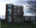
DN40 2NG is a small, tightly knit residential cluster in England, home to around 1372 residents. The area’s compact size fosters a quiet, community-focused atmosphere, with homes predominantly occupied by owners rather than renters. Daily life here is shaped by its proximity to essential amenities and reliable transport links. The median age of 47 suggests a stable population, with many residents in their prime working years or approaching retirement. This is a place where practicality meets simplicity, with no grand urban sprawl but a clear emphasis on accessibility. The absence of major environmental constraints, such as protected woodlands or flood zones, means development is unencumbered. For those seeking a low-maintenance lifestyle, DN40 2NG offers a balance of safety, convenience, and a strong sense of local identity. Its rail connections and retail options provide the essentials without the noise of larger towns, making it ideal for those who value a slower pace of life.
- Area Type
- Postcode
- Area Size
- Not available
- Population
- 1372
- Population Density
- 2286 people/km²
The property market in DN40 2NG is characterised by a high rate of home ownership, with 77% of properties occupied by owners rather than renters. This suggests a stable, long-term resident base with little turnover. The accommodation type is predominantly houses, which are typically larger and more suited to established families or individuals seeking space. As a small area, the housing stock is limited, but this also means properties are likely to be well-maintained and in demand. Buyers should consider the scarcity of available homes, as the market may be competitive. The focus on owner-occupation implies fewer rental properties, which could be advantageous for those seeking a permanent residence but less so for investors. The absence of environmental constraints, such as protected areas, means development is not restricted, though the area’s small size limits expansion. For buyers, this means a niche market with predictable demand but limited choice.
House Prices in DN40 2NG
No properties found in this postcode.
Energy Efficiency in DN40 2NG
Living in DN40 2NG offers access to essential retail and transport hubs within practical reach. The nearby shops include Aldi, Farmfoods, and Tesco in Immingham, providing everyday groceries and household items. These stores cater to a range of needs, from quick errands to weekly shopping. The rail network is particularly well-served, with stations like Stallingborough, Habrough, and Healing offering connections to surrounding areas. This makes commuting or visiting nearby towns straightforward. While the area lacks large leisure facilities, the proximity to rail links and retail options ensures residents can access broader amenities without significant travel. The character of daily life here is defined by convenience and simplicity, with no need for long commutes to basic services. The combination of practical retail and reliable transport creates a self-contained yet connected environment, ideal for those prioritising accessibility over urban amenities.
Amenities
Schools
| Rank | School | Type | Entry gender | Ages |
|---|
Explore more schools in this area
Go to Schools tabDemographics
The community in DN40 2NG is predominantly composed of adults aged 30–64, with a median age of 47. This suggests a mature, established population, likely with strong ties to local institutions and long-term residency. Home ownership is high, at 77%, indicating a stable market with few rental properties. The area’s accommodation is largely houses, which aligns with the demographic profile of older, family-oriented households. The predominant ethnic group is White, reflecting a homogenous community. While this data does not provide specific figures on deprivation, the low crime risk and absence of environmental constraints suggest a generally high quality of life. The age range and home ownership rates imply a population that is largely self-sufficient, with fewer young families or transient residents. This creates a consistent, low-maintenance environment where residents are likely to remain for extended periods.
Household Size
Accommodation Type
Tenure
Ethnic Group
Religion
Household Composition
Age
Household Deprivation
NS-SEC
Explore more demographic insights in this area
Go to Demographics tabPlanning
Planning Constraints
- Flood RiskPremium
- Ramsar Wetland SitesPremium
- Area of Outstanding Natural BeautyPremium
- Protected Nature ReservePremium
- Protected WoodlandPremium