Area Overview for DN40 2JG
Photos of DN40 2JG


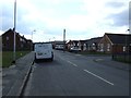
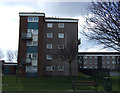
20 photos from this area
Area Information
Key information about the DN40 2JG including its size, population, and administrative classification.
- Area Type
- Postcode
- Area Size
- 3.7 hectares
- Population
- 1372
- Population Density
- 2286 people/km²
House Prices in DN40 2JG
22
Properties
£115,847
Average Sold Price
£31,413
Lowest Price
£162,000
Highest Price
Showing 22 properties
| Address | Type | Beds | Baths | Last Sale Price | Last Sale Date | |
|---|---|---|---|---|---|---|
| 89 Woodlands Avenue, Immingham, DN40 2JG | Detached | 3 | 1 | £160,000 | Mar 2025 | |
| 71 Woodlands Avenue, Immingham, DN40 2JG | Bungalow | 2 | 1 | £160,000 | Apr 2022 | |
| 91 Woodlands Avenue, Immingham, DN40 2JG | Bungalow | - | - | £141,000 | Nov 2021 | |
| 57 Woodlands Avenue, Immingham, DN40 2JG | Bungalow | - | - | £162,000 | Apr 2021 | |
| 95 Woodlands Avenue, Immingham, DN40 2JG | house | - | - | £115,000 | Jun 2018 | |
| 87 Woodlands Avenue, Immingham, DN40 2JG | Bungalow | - | - | £129,950 | Nov 2015 | |
| 59 Woodlands Avenue, Immingham, DN40 2JG | house | - | - | £120,000 | Oct 2015 | |
| 55 Woodlands Avenue, Immingham, DN40 2JG | Detached | - | - | £124,950 | Feb 2008 | |
| 69 Woodlands Avenue, Immingham, DN40 2JG | Detached | - | - | £31,413 | Oct 2004 | |
| 97 Woodlands Avenue, Immingham, DN40 2JG | Detached | 3 | 1 | £85,000 | Jul 2004 |
Page 1 of 3
Energy Efficiency in DN40 2JG
Amenities
Schools
| Rank | School | Type | Entry gender | Ages |
|---|
Explore more schools in this area
Go to Schools tabDemographics
Household Size
Two person
most common
Accommodation Type
Houses
most common
Tenure
77
majority
Ethnic Group
White
most common
Religion
N/A
most common
Household Composition
N/A
most common
Age
47
median
Adults (30-64 years)
most common
Household Deprivation
N/A
with no deprivation
NS-SEC
20
in Lower managerial occupations
Explore more demographic insights in this area
Go to Demographics tabPlanning
Planning Constraints
- Flood RiskPremium
- Ramsar Wetland SitesPremium
- Area of Outstanding Natural BeautyPremium
- Protected Nature ReservePremium
- Protected WoodlandPremium