Area Overview for DN40 1QE
Photos of DN40 1QE
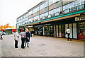
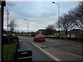
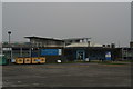
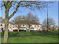
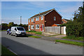
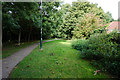
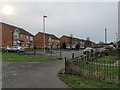
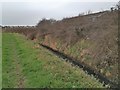

14 photos from this area
Area Information
Key information about the DN40 1QE including its size, population, and administrative classification.
- Area Type
- Postcode
- Area Size
- 2.4 hectares
- Population
- 1394
- Population Density
- 3531 people/km²
House Prices in DN40 1QE
43
Properties
£90,036
Average Sold Price
£17,000
Lowest Price
£155,000
Highest Price
Showing 43 properties
| Address | Type | Beds | Baths | Last Sale Price | Last Sale Date | |
|---|---|---|---|---|---|---|
| 252 Pelham Road, Immingham, DN40 1QE | house | - | - | £114,000 | Jul 2024 | |
| 230 Pelham Road, Immingham, DN40 1QE | Terraced | 3 | 1 | £120,000 | May 2023 | |
| 196 Pelham Road, Immingham, DN40 1QE | Retail | 3 | 1 | £141,000 | Mar 2022 | |
| 208 Pelham Road, Immingham, DN40 1QE | Bungalow | - | - | £115,000 | Nov 2021 | |
| 224 Pelham Road, Immingham, DN40 1QE | Bungalow | - | - | £132,000 | Aug 2021 | |
| 246 Pelham Road, Immingham, DN40 1QE | house | - | - | £142,000 | Jan 2021 | |
| 238 Pelham Road, Immingham, DN40 1QE | house | 3 | - | £115,000 | Sep 2020 | |
| 270 Pelham Road, Immingham, DN40 1QE | Bungalow | 2 | 1 | £135,000 | Jul 2020 | |
| 218 Pelham Road, Immingham, DN40 1QE | Bungalow | 4 | 1 | £130,000 | Jul 2019 | |
| 212 Pelham Road, Immingham, DN40 1QE | Bungalow | - | - | £100,000 | Mar 2019 |
Page 1 of 5
Energy Efficiency in DN40 1QE
Amenities
Schools
| Rank | School | Type | Entry gender | Ages |
|---|
Explore more schools in this area
Go to Schools tabDemographics
Household Size
One person
most common
Accommodation Type
Houses
most common
Tenure
39
majority
Ethnic Group
White
most common
Religion
N/A
most common
Household Composition
N/A
most common
Age
47
median
Adults (30-64 years)
most common
Household Deprivation
N/A
with no deprivation
NS-SEC
11
in Lower managerial occupations
Explore more demographic insights in this area
Go to Demographics tabPlanning
Planning Constraints
- Flood RiskPremium
- Ramsar Wetland SitesPremium
- Area of Outstanding Natural BeautyPremium
- Protected Nature ReservePremium
- Protected WoodlandPremium