Area Overview for DN4 9LS
Photos of DN4 9LS


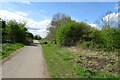


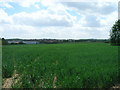
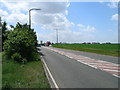
15 photos from this area
Area Information
Key information about the DN4 9LS including its size, population, and administrative classification.
- Area Type
- Postcode
- Area Size
- 12.3 hectares
- Population
- 1338
- Population Density
- 1948 people/km²
House Prices in DN4 9LS
60
Properties
£82,202
Average Sold Price
£26,950
Lowest Price
£155,000
Highest Price
Showing 60 properties
| Address | Type | Beds | Baths | Last Sale Price | Last Sale Date | |
|---|---|---|---|---|---|---|
| 124 Edlington Lane, Warmsworth, Doncaster, DN4 9LS | house | 3 | 1 | £150,000 | Sep 2025 | |
| 64 Edlington Lane, Warmsworth, Doncaster, DN4 9LS | Terraced | 2 | 1 | £80,000 | Apr 2025 | |
| 66 Edlington Lane, Warmsworth, Doncaster, DN4 9LS | house | - | - | £92,000 | May 2024 | |
| 8 Edlington Lane, Warmsworth, Doncaster, DN4 9LS | Terraced | 2 | 1 | £78,000 | Feb 2024 | |
| 20 Edlington Lane, Warmsworth, Doncaster, DN4 9LS | Terraced | 3 | 1 | £155,000 | Sep 2023 | |
| 28 Edlington Lane, Warmsworth, Doncaster, DN4 9LS | Terraced | 2 | 1 | £113,000 | May 2023 | |
| 54 Edlington Lane, Warmsworth, Doncaster, DN4 9LS | Terraced | 2 | 1 | £58,500 | Apr 2023 | |
| 88 Edlington Lane, Warmsworth, Doncaster, DN4 9LS | house | 3 | 1 | £93,500 | Jan 2023 | |
| 46 Edlington Lane, Warmsworth, Doncaster, DN4 9LS | Terraced | 2 | 1 | £90,000 | Sep 2022 | |
| 74 Edlington Lane, Warmsworth, Doncaster, DN4 9LS | house | - | - | £84,000 | Oct 2021 |
Page 1 of 6
Energy Efficiency in DN4 9LS
Amenities
Schools
| Rank | School | Type | Entry gender | Ages |
|---|
Explore more schools in this area
Go to Schools tabDemographics
Household Size
Two person
most common
Accommodation Type
Houses
most common
Tenure
53
majority
Ethnic Group
White
most common
Religion
N/A
most common
Household Composition
N/A
most common
Age
47
median
Adults (30-64 years)
most common
Household Deprivation
N/A
with no deprivation
NS-SEC
18
in Lower managerial occupations
Explore more demographic insights in this area
Go to Demographics tabPlanning
Planning Constraints
- Flood RiskPremium
- Ramsar Wetland SitesPremium
- Area of Outstanding Natural BeautyPremium
- Protected Nature ReservePremium
- Protected WoodlandPremium