Area Overview for DN4 9HF
Photos of DN4 9HF
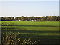


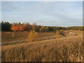
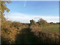
30 photos from this area
Area Information
Key information about the DN4 9HF including its size, population, and administrative classification.
- Area Type
- Postcode
- Area Size
- 1.5 hectares
- Population
- Not available
- Population Density
- Not available
House Prices in DN4 9HF
13
Properties
£128,850
Average Sold Price
£55,000
Lowest Price
£185,000
Highest Price
Showing 13 properties
| Address | Type | Beds | Baths | Last Sale Price | Last Sale Date | |
|---|---|---|---|---|---|---|
| 15 Wychwood Close, Balby, Doncaster, DN4 9HF | Semi-detached | 3 | 1 | £185,000 | Oct 2024 | |
| 9 Wychwood Close, Balby, Doncaster, DN4 9HF | house | - | - | £125,000 | May 2021 | |
| 3 Wychwood Close, Balby, Doncaster, DN4 9HF | Semi-detached | 4 | 2 | £151,000 | Sep 2020 | |
| 6 Wychwood Close, Balby, Doncaster, DN4 9HF | Bungalow | 2 | 1 | £112,000 | Sep 2018 | |
| 2 Wychwood Close, Balby, Doncaster, DN4 9HF | Bungalow | 4 | - | £140,000 | Sep 2018 | |
| 19 Wychwood Close, Balby, Doncaster, DN4 9HF | house | - | - | £132,500 | Jul 2018 | |
| 17 Wychwood Close, Balby, Doncaster, DN4 9HF | Semi-detached | 3 | - | £130,500 | Oct 2016 | |
| 4 Wychwood Close, Balby, Doncaster, DN4 9HF | Semi-detached | 2 | - | £114,000 | Oct 2015 | |
| 11 Wychwood Close, Balby, Doncaster, DN4 9HF | Semi-detached | - | - | £143,500 | Sep 2007 | |
| 8 Wychwood Close, Balby, Doncaster, DN4 9HF | Semi-detached | - | - | £55,000 | Apr 2002 |
Page 1 of 2
Energy Efficiency in DN4 9HF
Amenities
Schools
| Rank | School | Type | Entry gender | Ages |
|---|
Explore more schools in this area
Go to Schools tabDemographics
Household Size
Two person
most common
Accommodation Type
Houses
most common
Tenure
84
majority
Ethnic Group
White
most common
Religion
N/A
most common
Household Composition
N/A
most common
Age
47
median
Adults (30-64 years)
most common
Household Deprivation
N/A
with no deprivation
NS-SEC
28
in Lower managerial occupations
Explore more demographic insights in this area
Go to Demographics tabPlanning
Planning Constraints
- Flood RiskPremium
- Ramsar Wetland SitesPremium
- Area of Outstanding Natural BeautyPremium
- Protected Nature ReservePremium
- Protected WoodlandPremium