Area Overview for DN4 8TE
Photos of DN4 8TE
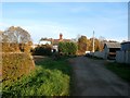
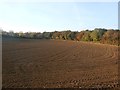
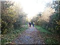
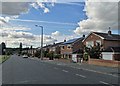
31 photos from this area
Area Information
Key information about the DN4 8TE including its size, population, and administrative classification.
- Area Type
- Postcode
- Area Size
- 9196 m²
- Population
- 1913
- Population Density
- 2634 people/km²
House Prices in DN4 8TE
16
Properties
£165,488
Average Sold Price
£83,000
Lowest Price
£265,000
Highest Price
Showing 16 properties
| Address | Type | Beds | Baths | Last Sale Price | Last Sale Date | |
|---|---|---|---|---|---|---|
| 1 Brayton Drive, Balby, Doncaster, DN4 8TE | house | - | - | £230,000 | Feb 2021 | |
| 11 Brayton Drive, Balby, Doncaster, DN4 8TE | Detached | 4 | 3 | £235,000 | Sep 2019 | |
| 12 Brayton Drive, Balby, Doncaster, DN4 8TE | Detached | 4 | 1 | £230,000 | Aug 2019 | |
| 9 Brayton Drive, Balby, Doncaster, DN4 8TE | house | - | - | £230,000 | Jun 2019 | |
| 3 Brayton Drive, Balby, Doncaster, DN4 8TE | Detached | 4 | 4 | £209,000 | Jan 2018 | |
| 21 Brayton Drive, Balby, Doncaster, DN4 8TE | house | - | - | £265,000 | May 2016 | |
| 15 Brayton Drive, Balby, Doncaster, DN4 8TE | Detached | 4 | - | £220,000 | Dec 2015 | |
| 5 Brayton Drive, Balby, Doncaster, DN4 8TE | Detached | 4 | 1 | £166,000 | Sep 2012 | |
| 2 Brayton Drive, Balby, Doncaster, DN4 8TE | Detached | 4 | 3 | £175,000 | Jul 2009 | |
| 8 Brayton Drive, Balby, Doncaster, DN4 8TE | Detached | - | - | £145,000 | Feb 2003 |
Page 1 of 2
Energy Efficiency in DN4 8TE
Amenities
Schools
| Rank | School | Type | Entry gender | Ages |
|---|
Explore more schools in this area
Go to Schools tabDemographics
Household Size
Family (3-5 people)
most common
Accommodation Type
Houses
most common
Tenure
83
majority
Ethnic Group
White
most common
Religion
N/A
most common
Household Composition
N/A
most common
Age
47
median
Adults (30-64 years)
most common
Household Deprivation
N/A
with no deprivation
NS-SEC
38
in Lower managerial occupations
Explore more demographic insights in this area
Go to Demographics tabPlanning
Planning Constraints
- Flood RiskPremium
- Ramsar Wetland SitesPremium
- Area of Outstanding Natural BeautyPremium
- Protected Nature ReservePremium
- Protected WoodlandPremium