Area Overview for DN39 6XY
Photos of DN39 6XY


Area Information
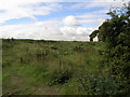
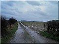
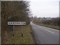
Living in DN39 6XY means inhabiting a small, low-density residential cluster in England, where the population of 1,622 residents spreads across 59 people per square kilometre. This is a quiet, tightly knit area, more akin to a village than a sprawling town. The demographic profile suggests a mature community, with a median age of 47 and a majority of residents aged 30–64. Daily life here is likely shaped by proximity to local amenities and the slower pace of rural living. The area’s compact size means most needs are met within a short distance, though its small footprint also limits the range of services. Residents benefit from nearby primary schools, rail access, and retail options, which, combined with low crime rates, create a stable environment. However, the broadband connectivity score of 31 indicates limited internet infrastructure, which could affect those reliant on high-speed connections for work or entertainment. For those seeking a peaceful, family-oriented setting with a strong sense of community, DN39 6XY offers a distinct alternative to busier urban centres.
- Area Type
- Postcode
- Area Size
- Not available
- Population
- 1622
- Population Density
- 59 people/km²
The property market in DN39 6XY is dominated by owner-occupied homes, with 71% of residents living in properties they own. This high home ownership rate suggests a stable market where long-term residency is common. The accommodation type is exclusively houses, which is typical for rural or semi-rural areas where larger properties are more prevalent. This contrasts with urban centres where flats or apartments dominate. For buyers, this means the available housing stock is likely to be traditional, with limited rental options. The small size of the area means the market is niche, with fewer properties available compared to larger towns. However, the low crime rate and proximity to schools and transport may make it attractive for families seeking a quieter lifestyle. Potential buyers should consider the limited broadband infrastructure, which could impact those reliant on high-speed internet for work or leisure.
House Prices in DN39 6XY
No properties found in this postcode.
Energy Efficiency in DN39 6XY
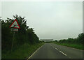
The lifestyle in DN39 6XY is shaped by its proximity to essential amenities, though the range is limited by the area’s small size. Residents have access to five retail outlets, including Co-op High and Lincolnshire Co-operative Co, which provide basic grocery and household goods. The presence of four railway stations—Barnetby, Ulceby, and Habrough—offers connections to regional transport networks, though specific service details are not provided. For air travel, Humberside Airport is within reach, though its utility depends on individual travel needs. The area lacks detailed information on leisure or recreational facilities, but the low crime rate and quiet environment suggest a focus on simplicity and safety. The nearby primary schools and modest retail options cater to daily living, making DN39 6XY suitable for those prioritising convenience over extensive amenities.
Amenities
Schools
Residents of DN39 6XY have access to two primary schools within practical reach: Kirmington CofE Primary School and Wootton St Andrew’s CofE Primary School. Both are rated ‘good’ by Ofsted, indicating a reliable standard of education for younger children. The presence of two primary schools suggests that families with young children have multiple options for schooling, though no secondary schools are listed in the data. This could mean that students may need to travel further for secondary education, depending on local provision. The schools’ ‘good’ ratings reflect a commitment to quality teaching, which is a key consideration for parents. However, the absence of data on secondary education or specialist facilities means families may need to plan for additional travel or alternative schooling arrangements.
| Rank | School | Type | Entry gender | Ages |
|---|
Explore more schools in this area
Go to Schools tabDemographics
The community in DN39 6XY is predominantly composed of adults aged 30–64, with a median age of 47. This suggests a population skewed towards middle-aged individuals, likely including many families and professionals in their peak earning years. Home ownership is high at 71%, indicating a stable, long-term resident base rather than a transient rental market. The area is characterised by houses rather than flats, aligning with the demographic profile of established households. The predominant ethnic group is White, with no data provided on other ethnicities. The low population density of 59 people per square kilometre reinforces the rural, spread-out nature of the area. While no specific data on deprivation is available, the high home ownership rate and low crime score imply a relatively affluent or stable community. This profile may appeal to buyers seeking a settled, family-friendly environment with minimal urban pressures.
Household Size
Accommodation Type
Tenure
Ethnic Group
Religion
Household Composition
Age
Household Deprivation
NS-SEC
Explore more demographic insights in this area
Go to Demographics tabPlanning
Planning Constraints
- Flood RiskPremium
- Ramsar Wetland SitesPremium
- Area of Outstanding Natural BeautyPremium
- Protected Nature ReservePremium
- Protected WoodlandPremium