Area Overview for DN38 6AE
Photos of DN38 6AE


Area Information
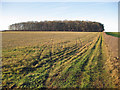
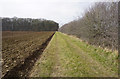
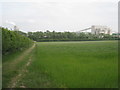
Living in DN38 6AE means being part of a small, tightly knit residential cluster in England. The area spans 22.8 hectares and is home to 1,622 residents, giving it a low population density of 59 people per square kilometre. This suggests a quiet, spacious environment where neighbours are likely to know one another. The community is predominantly composed of adults aged 30–64, with a median age of 47, indicating a stable, mature demographic. Most homes are owner-occupied, reflecting a sense of long-term commitment to the area. Daily life here is likely to revolve around local amenities, family life, and proximity to nearby towns. The area’s compact size means residents can access nearby services without long commutes, though the lack of major urban infrastructure points to a more rural or semi-rural lifestyle. For those seeking a peaceful, low-density living environment with a strong sense of community, DN38 6AE offers a distinct alternative to larger, more congested areas.
- Area Type
- Postcode
- Area Size
- 22.8 hectares
- Population
- 1622
- Population Density
- 59 people/km²
The property market in DN38 6AE is characterised by a high rate of home ownership—71% of residents own their homes. This suggests a community where property is viewed as a long-term investment rather than a short-term rental asset. The predominant accommodation type is houses, which is unusual for areas with higher population densities but aligns with the low population density of 59 people per square kilometre. This implies a focus on family-oriented, spacious living arrangements, possibly with gardens or larger plots. For buyers, this means a market that is less influenced by rental demand and more by the appeal of private, owner-occupied homes. The small size of the area means property choices are limited, but the emphasis on houses may appeal to those seeking a quieter, more traditional living environment. Potential buyers should consider the area’s limited size and the likelihood of competition for available properties.
House Prices in DN38 6AE
No properties found in this postcode.
Energy Efficiency in DN38 6AE
The lifestyle in DN38 6AE is shaped by its proximity to practical amenities. Residents can access five retail venues, including Lincolnshire Co-operative Co and Co-op High, offering everyday shopping needs. Five railway stations—Barnetby, Ulceby, and Habrough—provide regular links to nearby towns, supporting both work and leisure travel. Two airports, both named Humberside Airport, are within reach, offering regional flight options. While the area lacks detailed information on parks or leisure facilities, the presence of rail and retail options suggests a lifestyle focused on convenience and connectivity. The small size of the area means amenities are likely to be clustered, reducing travel time for essential services. For those prioritising ease of access to shopping, transport, and regional travel, DN38 6AE offers a functional, if modest, range of options.
Amenities
Schools
Residents of DN38 6AE have access to two primary schools: Kirmington CofE Primary School and Wootton St Andrew’s CofE Primary School. Both are rated as ‘good’ by Ofsted, indicating a reliable standard of education for younger children. The presence of two primary schools suggests that families with young children can choose between options, though no secondary schools are listed in the data. This means parents may need to look further afield for secondary education, which could be a consideration for those planning long-term in the area. The ‘good’ Ofsted ratings reflect a commitment to quality teaching and facilities, which is reassuring for families prioritising education. However, the absence of secondary schools highlights a potential limitation for those requiring a full range of educational services within the immediate vicinity.
| Rank | School | Type | Entry gender | Ages |
|---|
Explore more schools in this area
Go to Schools tabDemographics
The population of DN38 6AE is 1,622, with a median age of 47. This places the community firmly in the adult demographic, with the majority of residents falling within the 30–64 age range. Home ownership is high, at 71%, suggesting a stable, long-term resident base. The predominant accommodation type is houses, which aligns with the area’s low population density and likely suburban or rural character. The predominant ethnic group is White, though no further breakdown of diversity is provided. The absence of specific data on deprivation means it is unclear how socioeconomic factors might influence quality of life. However, the high home ownership rate and mature age profile suggest a community that values stability and permanence. For buyers, this indicates a market where properties are likely to be occupied by long-term residents, potentially reducing turnover and maintaining property value consistency.
Household Size
Accommodation Type
Tenure
Ethnic Group
Religion
Household Composition
Age
Household Deprivation
NS-SEC
Explore more demographic insights in this area
Go to Demographics tabPlanning
Planning Constraints
- Flood RiskPremium
- Ramsar Wetland SitesPremium
- Area of Outstanding Natural BeautyPremium
- Protected Nature ReservePremium
- Protected WoodlandPremium