Area Overview for DN37 8DP
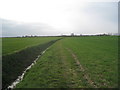
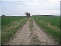
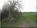
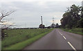
Photos of DN37 8DP


Area Information
DN37 8DP is a small, tightly knit residential area in England, home to around 1324 people spread across 72 people per square kilometre. Its compact size means it feels like a quiet, self-contained community, where daily life revolves around local routines and familiar faces. The area’s demographics suggest a mature population, with a median age of 47 and most residents falling within the 30–64 age range. This hints at a stable, established community, likely with strong family ties and long-term residency. The low crime risk score of 73, combined with no flood or environmental hazards, makes it a safe and secure place to live. While the area is small, its proximity to rail networks and major roads ensures connectivity without sacrificing the tranquillity of a rural setting. For those seeking a peaceful yet practical location, DN37 8DP offers a blend of security, simplicity, and accessibility that is rare in today’s housing market.
- Area Type
- Postcode
- Area Size
- Not available
- Population
- 1324
- Population Density
- 72 people/km²
The property market in DN37 8DP is characterised by a high rate of home ownership, with 79% of residents owning their homes. This suggests a stable, long-term market with limited rental activity, as the area is not a hub for transient populations. The accommodation type is predominantly houses, which is unusual for a small postcode area but may reflect the community’s preference for larger, family-friendly properties. Given the low population density and the absence of high-density housing, the area likely has a limited number of properties available for purchase. For buyers, this means competition may be fierce, particularly for homes that meet the needs of families or those seeking more space. The small size of the area also means that the surrounding regions may offer more options, though proximity to DN37 8DP’s amenities and safety profile could make it an attractive choice for those prioritising security and quiet living.
House Prices in DN37 8DP
No properties found in this postcode.
Energy Efficiency in DN37 8DP
The lifestyle in DN37 8DP is shaped by its proximity to essential amenities. Local shops such as Lincolnshire Co-operative Co, Spar, and Sainsburys Immingham provide everyday retail needs, ensuring residents have access to groceries and household supplies without long journeys. The area’s rail stations, including Stallingborough and Habrough, offer regular services that connect to broader networks, facilitating travel for work, shopping, or leisure. The presence of Humberside Airport adds to the area’s accessibility, particularly for those requiring regional or national travel. While the data does not mention parks or leisure facilities, the absence of planning constraints like protected woodlands or AONB areas suggests there may be space for local green areas or recreational opportunities. The combination of retail, transport, and travel options creates a practical lifestyle, where daily needs are met without sacrificing the area’s quiet, community-focused character.
Amenities
Schools
The nearest school to DN37 8DP is Stallingborough CofE Primary School, which provides education for younger children. The school is rated as 'good' by Ofsted, indicating a reliable standard of teaching and facilities. However, the data does not mention secondary schools in the area, which may mean families would need to look beyond DN37 8DP for secondary education. This could be a consideration for those planning for long-term schooling needs. The presence of a well-rated primary school is a positive for families with young children, but the absence of local secondary options may require careful planning. The school’s location within the area suggests it is accessible to most residents, though specific travel times are not provided.
| Rank | School | Type | Entry gender | Ages |
|---|
Explore more schools in this area
Go to Schools tabDemographics
The community in DN37 8DP is predominantly composed of adults aged 30–64, with a median age of 47. This suggests a population that is largely settled, with fewer young families or retirees compared to other areas. Home ownership is high, with 79% of residents living in their own homes, indicating a stable and long-term demographic. The accommodation type is primarily houses, which aligns with the area’s low population density and suggests a focus on family homes rather than apartments or flats. The predominant ethnic group is White, with no specific data on other groups provided. The absence of detailed diversity metrics means the community’s cultural composition remains largely unexplored in the data. However, the high home ownership rate and mature age profile imply a low turnover of residents, contributing to a cohesive, familiar social environment.
Household Size
Accommodation Type
Tenure
Ethnic Group
Religion
Household Composition
Age
Household Deprivation
NS-SEC
Explore more demographic insights in this area
Go to Demographics tabPlanning
Planning Constraints
- Flood RiskPremium
- Ramsar Wetland SitesPremium
- Area of Outstanding Natural BeautyPremium
- Protected Nature ReservePremium
- Protected WoodlandPremium