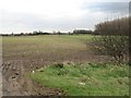
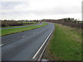
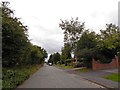
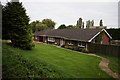
Area Overview for DN37 7HB
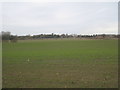
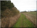
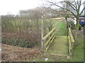
Photos of DN37 7HB

Area Information
Living in DN37 7HB means being part of a small, tightly knit residential cluster in England. With a population of 1,428 spread across 2.2 hectares, the area has a low population density of 91 people per square kilometre, suggesting a quiet, community-oriented environment. This postcode is characterised by its compact size and focus on housing, with most properties being owner-occupied. The area’s proximity to rail networks and local retail options makes it practical for daily life, while its moderate size ensures a sense of familiarity for residents. The median age of 47 indicates a mature population, with the majority of residents falling within the 30–64 age range. This suggests a stable community where many have long-term ties to the area. For those seeking a place to settle, DN37 7HB offers a blend of simplicity and accessibility, with no major environmental constraints or flood risks. However, its small scale means it is not a hub for large-scale amenities or services, requiring residents to look slightly further afield for broader opportunities.
- Area Type
- Postcode
- Area Size
- 2.2 hectares
- Population
- 1428
- Population Density
- 91 people/km²
The property market in DN37 7HB is dominated by owner-occupied homes, with 86% of residents living in properties they own. This high rate of home ownership suggests a stable, long-term community with little turnover. The accommodation type is exclusively houses, which is unusual for areas with higher population densities but aligns with the area’s compact, low-density layout. This means the housing stock is likely to consist of semi-detached or detached properties, offering more space than flats or apartments. The small size of the area—just 2.2 hectares—implies a limited number of properties, which may make the market competitive for buyers. However, the absence of rental properties or high-density housing means the area is not a hotspot for investors or those seeking short-term lets. For buyers, this suggests a focus on established, private homes rather than a dynamic rental market. The lack of environmental constraints or planning restrictions also means properties here are unlikely to face development pressures that could affect their value.
House Prices in DN37 7HB
Showing 14 properties
| Address | Type | Beds | Baths | Last Sale Price | Last Sale Date | |
|---|---|---|---|---|---|---|
| 45 Charles Avenue, Laceby, DN37 7HB | Semi-detached | 3 | 2 | £151,000 | Nov 2024 | |
| 61 Charles Avenue, Laceby, DN37 7HB | Bungalow | 3 | 1 | £174,000 | Jun 2021 | |
| 65 Charles Avenue, Laceby, DN37 7HB | Bungalow | - | - | £130,000 | May 2021 | |
| 59 Charles Avenue, Laceby, DN37 7HB | Bungalow | 2 | 1 | £149,950 | Jan 2016 | |
| 53 Charles Avenue, Laceby, DN37 7HB | Bungalow | 2 | - | £85,000 | Mar 2012 | |
| 51 Charles Avenue, Laceby, DN37 7HB | Bungalow | - | - | £144,000 | May 2008 | |
| 63 Charles Avenue, Laceby, DN37 7HB | Semi-detached | - | - | £149,950 | Feb 2008 | |
| 69 Charles Avenue, Laceby, DN37 7HB | Semi-detached | - | - | £105,000 | Oct 2005 | |
| 49 Charles Avenue, Laceby, DN37 7HB | Semi-detached | - | - | £39,000 | Sep 1999 | |
| 67 Charles Avenue, Laceby, DN37 7HB | Semi-detached | - | - | £43,500 | Nov 1996 |
Energy Efficiency in DN37 7HB
The lifestyle in DN37 7HB is defined by its proximity to essential retail and transport hubs. Within practical reach, residents have access to five retail outlets, including Lincolnshire Co-operative Co-op hire, Spar, and Morrisons Grange, providing a range of grocery and convenience shopping options. These stores cater to daily needs, reducing the necessity for long trips to larger centres. The area’s rail network is also well-served, with five nearby stations offering connections to regional towns and cities. This rail access supports both local travel and commuting, though leisure and recreational facilities are not explicitly mentioned in the data. The absence of parks or cultural venues means residents may need to venture beyond the area for such amenities. However, the combination of retail and transport options ensures a functional, if modest, lifestyle that prioritises practicality over expansive leisure opportunities.
Amenities
Schools
The nearest school to DN37 7HB is Best Futures, a special school with an Ofsted rating of satisfactory. This indicates that the area’s educational provision is tailored to students with specific needs, though there is no data on mainstream primary or secondary schools nearby. The presence of a special school suggests that families with children requiring additional support may find the area suitable, but those seeking a range of school types may need to look beyond the immediate vicinity. The single school listed in the data does not provide a comprehensive educational ecosystem, which could be a consideration for families prioritising access to multiple school options. Parents should assess whether the availability of a special school meets their child’s requirements or if they would need to commute to other areas for broader educational opportunities.
| Rank | School | Type | Entry gender | Ages |
|---|
Explore more schools in this area
Go to Schools tabDemographics
DN37 7HB has a median age of 47, with the majority of its population aged between 30 and 64. This reflects a mature, established community where most residents are likely to be in their prime working years or beyond. Home ownership is exceptionally high at 86%, indicating a strong preference for long-term residency over rental properties. The accommodation type is predominantly houses, which aligns with the area’s residential character and the absence of high-density housing. The predominant ethnic group is White, which is consistent with broader regional demographics. The population density of 91 people per square kilometre is low, contributing to a less congested living environment. This data suggests a community that values stability and private ownership, with little reliance on rental markets or transient populations. The age profile also implies a population that may be more inclined to prioritise family-oriented or retirement-focused living, though the absence of specific data on deprivation means the quality of life cannot be fully contextualised beyond these figures.
Household Size
Accommodation Type
Tenure
Ethnic Group
Religion
Household Composition
Age
Household Deprivation
NS-SEC
Explore more demographic insights in this area
Go to Demographics tabPlanning
Planning Constraints
- Flood RiskPremium
- Ramsar Wetland SitesPremium
- Area of Outstanding Natural BeautyPremium
- Protected Nature ReservePremium
- Protected WoodlandPremium