Area Overview for DN37 7EB
Photos of DN37 7EB


Area Information
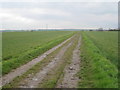
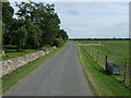
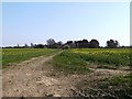
Living in DN37 7EB means being part of a small, tightly knit residential cluster in England. With a population of 1,428 spread across 91 people per square kilometre, this area offers a quiet, low-density lifestyle. The community is predominantly composed of adults aged 30–64, reflecting a mature demographic with a median age of 47. Most residents own their homes, with 86% of properties in private ownership, suggesting a stable, long-term presence. The area is defined by its housing stock, which is largely composed of houses rather than flats, contributing to a suburban feel. While the postcode covers a limited geographical footprint, it provides access to nearby amenities and transport links. Daily life here balances local convenience with proximity to larger towns, making it suitable for those seeking a peaceful environment without complete isolation. The low flood risk and absence of environmental constraints further support a sense of security, though residents should be mindful of the moderate crime risk in the area.
- Area Type
- Postcode
- Area Size
- Not available
- Population
- 1428
- Population Density
- 91 people/km²
The property market in DN37 7EB is characterised by high home ownership, with 86% of properties owned by residents rather than rented. This suggests a market dominated by owner-occupied homes, which are predominantly houses. The absence of flats or apartments indicates a focus on family-friendly housing, likely appealing to those seeking space and privacy. Given the small size of the postcode, the available housing stock is limited, meaning buyers may need to consider nearby areas for more options. The high home ownership rate also implies a stable market with fewer rental properties, which could be advantageous for long-term investors but may limit flexibility for those requiring short-term housing. The predominance of houses reflects a suburban or semi-rural character, which may be attractive to buyers prioritising space over density.
House Prices in DN37 7EB
No properties found in this postcode.
Energy Efficiency in DN37 7EB
Daily life in DN37 7EB is shaped by its proximity to retail and transport hubs. The area includes five notable retail outlets, such as Morrisons Grange, Morrisons Daily, and Spar, offering convenience for grocery shopping and everyday needs. Nearby railway stations like Great Coates and Healing provide access to broader networks, enabling travel to larger towns for leisure, work, or socialising. While the postcode itself has limited amenities, the surrounding area compensates with practical retail options and transport links. The absence of parks or leisure facilities within the postcode means residents often travel to nearby green spaces. However, the combination of local shops and rail access ensures a functional lifestyle, balancing self-sufficiency with regional connectivity.
Amenities
Schools
The nearest school to DN37 7EB is Best Futures, a special school with an Ofsted rating of satisfactory. This institution caters to students with specific educational needs, offering tailored support. While the area lacks mainstream primary or secondary schools, the presence of a special school indicates a focus on inclusive education for those requiring additional resources. Families with children who require specialised learning environments may find this a key advantage, though those seeking a broader range of schools will need to look beyond the immediate vicinity. The single school option underscores the importance of proximity to larger towns for comprehensive educational choices.
| Rank | School | Type | Entry gender | Ages |
|---|
Explore more schools in this area
Go to Schools tabDemographics
DN37 7EB’s population is predominantly made up of adults aged 30–64, with a median age of 47. This suggests a community with established careers and families, rather than a younger or retired population. The high home ownership rate of 86% indicates a strong preference for long-term residency, with most properties being houses rather than flats. The predominant ethnic group is White, which aligns with broader regional demographics. The absence of specific data on deprivation means quality of life is inferred from the stability of the housing market and the age profile, which typically correlates with lower dependency ratios. However, the moderate crime risk score of 54 implies that while safety is generally acceptable, residents should remain vigilant. The demographic makeup supports a community that values continuity and local connections, with limited turnover of residents.
Household Size
Accommodation Type
Tenure
Ethnic Group
Religion
Household Composition
Age
Household Deprivation
NS-SEC
Explore more demographic insights in this area
Go to Demographics tabPlanning
Planning Constraints
- Flood RiskPremium
- Ramsar Wetland SitesPremium
- Area of Outstanding Natural BeautyPremium
- Protected Nature ReservePremium
- Protected WoodlandPremium