Area Overview for DN37 0ZG
Photos of DN37 0ZG

Area Information
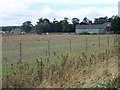
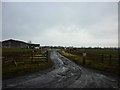
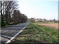
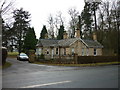
Living in DN37 0ZG involves residing within a specific postcode area that covers a small residential cluster spread over 2754 square metres. This compact footprint supports a population of 1157 people, creating a tightly knit environment where neighbours are likely within easy reach. The density stands at 22 people per square kilometre, a figure that confirms the area is sparsely populated compared to urban centres but offers the quiet of a village setting. You will find that daily life here revolves around a stable community rather than the transient nature of larger towns. The postcode serves as a gateway to the wider Lincolnshire countryside, blending the convenience of local amenities with a peaceful atmosphere. Prospective buyers seeking a tranquil home without the congestion of city traffic will appreciate the scale of this residential zone. It is an area defined by its modest size and a focus on family-oriented living rather than commercial bustle. The low density ensures that noise is generally low, making it suitable for those who prioritise relaxation alongside access to essential services.
- Area Type
- Postcode
- Area Size
- 2754 m²
- Population
- 1157
- Population Density
- 22 people/km²
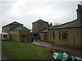
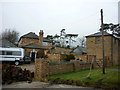
Understanding the property market in DN37 0ZG requires recognising its nature as a small residential cluster rather than a commercial hub. The housing stock is characterised by houses, which aligns perfectly with the demographic data showing a high proportion of adult households. With 80% of the population being homeowners, this is fundamentally an owner-occupied area where buying a property is the norm. You will find very few rental properties, meaning competition for homes in this postcode is likely to come from other buyers rather than tenants. The accommodation type data confirms that there are no flats or apartments mixed into the housing stock. This homogeneity creates a consistent market where buyers can expect a garden and space that matches the lifestyle of the established residents. Prices may reflect the lower population density, though specific valuation figures are not detailed here. If you are considering purchasing a home, your target should be a house that suits a family or older adult who does not require ground-floor accessibility or modern apartment living.
House Prices in DN37 0ZG
Showing 3 properties
| Address | Type | Beds | Baths | Last Sale Price | Last Sale Date | |
|---|---|---|---|---|---|---|
| 2 Hazel Court, Barnoldby Le Beck, DN37 0ZG | house | - | - | - | - | |
| 3 Hazel Court, Barnoldby Le Beck, DN37 0ZG | house | - | - | - | - | |
| 1 Hazel Court, Barnoldby Le Beck, DN37 0ZG | house | - | - | - | - |
Energy Efficiency in DN37 0ZG
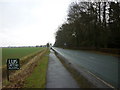
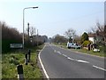
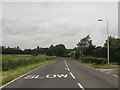
Your daily lifestyle in DN37 0ZG is supported by a practical range of amenities located just beyond the residential cluster. Five retail options are within practical reach, including the Lincolnshire Co-operative Co and Spar. These shops provide essential grocery and household needs without requiring a long journey into a larger town. For those who prefer the convenience of a local store, the presence of two Lincolnshire Co-operative Co outlets ensures that staple items are available nearby. Public transport connections are facilitated by five nearby railway stations, including Grimsby Town Railway Station, Great Coates Railway Station, and Grimsby Docks Railway Station. These stations offer vital links to broader transport networks, making it feasible to travel to nearby towns or the coast for leisure. There are no major leisure centres or parks listed within the immediate data, meaning your outdoor activities may centre on local walking routes rather than designated recreational facilities. The combination of local supermarkets and rail access makes DN37 0ZG a viable location for those who value independence over urban nightlife.
Amenities
Schools
Families living in DN37 0ZG benefit from proximity to two specific educational institutions within the immediate vicinity. East Ravendale CofE Primary School serves as a primary option for younger children in the postcode area. For children aged 11 and above, East Ravendale CofE Primary School Academy is the designated primary academy with an Ofsted rating of good. This rating indicates that the academy meets expected standards for education and pupil welfare. The availability of two schools, both focusing on primary education, suggests that this area is most suitable for families with younger children before they transfer to secondary institutions elsewhere. The presence of an academically rated school enhances the appeal of DN37 0ZG for parents seeking a safe educational environment. While no secondary schools are listed in the available data, the primary options provide a strong local foundation for household planning. Commuting to further education likely involves travel outside this specific residential cluster.
| Rank | School | Type | Entry gender | Ages |
|---|
Explore more schools in this area
Go to Schools tabDemographics
The community in DN37 0ZG mirrors a settled society with a median age of 47 years. The most common age range consists of adults between 30 and 64 years, indicating a population dominated by working-age families and established households. This demographic profile suggests a neighbourhood where long-term residents outnumber young professionals or retirees. Home ownership is extremely prevalent, with 80% of residents owning their property outright or with a mortgage. Such a high rate of ownership points to deep roots in the local area and a general financial stability among the inhabitants. The predominant ethnic group is White, reflecting the typical composition of rural Lincolnshire villages. Accommodation types are almost exclusively houses, aligning with the families and adults who make up the bulk of the population. There are no significant gaps in this data to suggest a diverse mix of rentals or social housing. The area functions as a traditional community where families look to build their lives over many decades rather than move frequently.
Household Size
Accommodation Type
Tenure
Ethnic Group
Religion
Household Composition
Age
Household Deprivation
NS-SEC
Explore more demographic insights in this area
Go to Demographics tabPlanning
Planning Constraints
- Flood RiskPremium
- Ramsar Wetland SitesPremium
- Area of Outstanding Natural BeautyPremium
- Protected Nature ReservePremium
- Protected WoodlandPremium