Area Overview for DN37 0XE
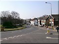
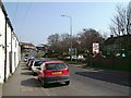
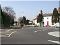
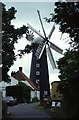
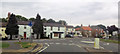
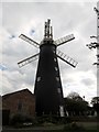
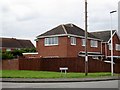
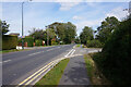
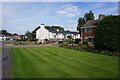
Photos of DN37 0XE


Area Information
Living in DN37 0XE means being part of a tightly knit residential cluster in England, where 1,137 people reside across just 2,592 square metres. This high population density creates a compact, community-oriented environment, with homes concentrated in a small area. The postcode is home to a mature population, with a median age of 47 and most residents aged between 30 and 64. Daily life here is shaped by proximity to essential services and a focus on local amenities. The area’s small size means neighbours are likely to be familiar faces, fostering a sense of cohesion. While the housing stock is limited, the predominantly owner-occupied nature of the area suggests long-term residency. The absence of major planning constraints or environmental restrictions adds to its practical appeal, though the high density may influence the character of the streetscape. For those seeking a quiet, established community with minimal external pressures, DN37 0XE offers a distinct contrast to larger urban areas.
- Area Type
- Postcode
- Area Size
- 2592 m²
- Population
- 1137
- Population Density
- 1633 people/km²
The property market in DN37 0XE is characterised by a strong presence of owner-occupied homes, with 55% of properties in private hands. The accommodation type is almost exclusively houses, which is unusual for a small postcode area and may indicate a focus on family homes or semi-detached properties. This suggests a market where long-term residency is common, with limited rental activity. The small size of the area means the housing stock is finite, which could lead to competition for available properties. Buyers should consider that the high population density may limit scope for expansion or new developments. For those seeking a home in this area, the emphasis on owner-occupation implies a stable market, though the lack of diversity in property types may restrict options. The proximity to rail links and schools could enhance the area’s appeal for families.
House Prices in DN37 0XE
Showing 30 properties
| Address | Type | Beds | Baths | Last Sale Price | Last Sale Date | |
|---|---|---|---|---|---|---|
| 26 Ronald Farmer Court, Waltham, DN37 0XE | Flat | - | - | - | - | |
| 7 Ronald Farmer Court, Waltham, DN37 0XE | Flat | - | - | - | - | |
| 9 Ronald Farmer Court, Waltham, DN37 0XE | Flat | - | - | - | - | |
| 6 Ronald Farmer Court, Waltham, DN37 0XE | Flat | - | - | - | - | |
| 5 Ronald Farmer Court, Waltham, DN37 0XE | Flat | - | - | - | - | |
| 13 Ronald Farmer Court, Waltham, DN37 0XE | Flat | - | - | - | - | |
| 8 Ronald Farmer Court, Waltham, DN37 0XE | Flat | - | - | - | - | |
| 12 Ronald Farmer Court, Waltham, DN37 0XE | Flat | - | - | - | - | |
| 17 Ronald Farmer Court, Waltham, DN37 0XE | house | - | - | - | - | |
| 2 Ronald Farmer Court, Waltham, DN37 0XE | Flat | - | - | - | - |
Energy Efficiency in DN37 0XE
The lifestyle in DN37 0XE is shaped by its proximity to essential retail and transport hubs. Five retail outlets, including Lincolnshire Co-operative Co and Spar, provide convenience for daily shopping needs. The rail network, with stations such as Grimsby Docks and Great Coates, offers direct links to nearby towns and cities, facilitating both commuting and leisure travel. While the data does not mention parks or leisure facilities, the compact nature of the area suggests that local amenities are prioritised for immediate access. The presence of multiple schools and shops indicates a community focused on practicality and family-oriented living. For residents, the balance of retail options and transport links ensures that daily errands and travel are efficiently managed, contributing to a functional yet cohesive lifestyle.
Amenities
Schools
Residents of DN37 0XE have access to several primary schools within practical reach. The Leas Junior School and The Leas Infants’ School provide early education for younger children, while Waltham Leas Primary School and Waltham Leas Primary Academy cater to a broader age range. The latter holds an Ofsted rating of ‘good’, indicating a standard of education that meets regulatory benchmarks. The concentration of primary schools suggests a focus on family-friendly infrastructure, though no secondary schools are listed in the data. This may require families to travel further for secondary education, which could be a consideration for those prioritising a full range of educational options. The presence of multiple primary schools, however, ensures that young children have nearby options, reducing the need for long commutes.
| Rank | School | Type | Entry gender | Ages |
|---|
Explore more schools in this area
Go to Schools tabDemographics
The community in DN37 0XE is predominantly composed of adults aged 30 to 64, with a median age of 47. This suggests a stable population with a strong presence of families and middle-aged residents. Home ownership is prevalent, with 55% of properties owned by their occupants, indicating a degree of long-term investment in the area. The accommodation is almost entirely houses, reflecting a preference for single-family living over flats or apartments. The predominant ethnic group is White, though the data does not specify further diversity metrics. The population density of 438,730 people per square kilometre is exceptionally high, which may influence the pace of life and the availability of shared spaces. This density, combined with the age profile, suggests a community where older residents may outnumber younger ones, potentially affecting local services and school demographics.
Household Size
Accommodation Type
Tenure
Ethnic Group
Religion
Household Composition
Age
Household Deprivation
NS-SEC
Explore more demographic insights in this area
Go to Demographics tabPlanning
Planning Constraints
- Flood RiskPremium
- Ramsar Wetland SitesPremium
- Area of Outstanding Natural BeautyPremium
- Protected Nature ReservePremium
- Protected WoodlandPremium