Area Overview for DN37 0QB
Photos of DN37 0QB
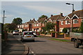
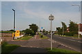
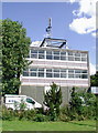
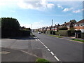
13 photos from this area
Area Information
Key information about the DN37 0QB including its size, population, and administrative classification.
- Area Type
- Postcode
- Area Size
- 2804 m²
- Population
- 1672
- Population Density
- 361 people/km²
House Prices in DN37 0QB
9
Properties
£168,158
Average Sold Price
£147,000
Lowest Price
£196,000
Highest Price
Showing 9 properties
| Address | Type | Beds | Baths | Last Sale Price | Last Sale Date | |
|---|---|---|---|---|---|---|
| 54 Danesfield Avenue, Waltham, DN37 0QB | Semi-detached | 3 | 1 | £170,000 | Jul 2025 | |
| 66 Danesfield Avenue, Waltham, DN37 0QB | Semi-detached | 4 | 1 | £196,000 | Aug 2021 | |
| 64 Danesfield Avenue, Waltham, DN37 0QB | Semi-detached | 3 | 1 | £156,000 | Nov 2017 | |
| 52 Danesfield Avenue, Waltham, DN37 0QB | Semi-detached | - | - | £180,000 | Jul 2016 | |
| 56 Danesfield Avenue, Waltham, DN37 0QB | Semi-detached | 3 | 1 | £147,000 | Dec 2014 | |
| 60 Danesfield Avenue, Waltham, DN37 0QB | house | - | - | £159,950 | May 2007 | |
| 58 Danesfield Avenue, Waltham, DN37 0QB | Semi-detached | 3 | 1 | - | - | |
| 68 Danesfield Avenue, Waltham, DN37 0QB | Semi-detached | 4 | - | - | - | |
| 62 Danesfield Avenue, Waltham, DN37 0QB | Semi-detached | - | - | - | - |
Energy Efficiency in DN37 0QB
Amenities
Schools
| Rank | School | Type | Entry gender | Ages |
|---|
Explore more schools in this area
Go to Schools tabDemographics
Household Size
Two person
most common
Accommodation Type
Houses
most common
Tenure
90
majority
Ethnic Group
White
most common
Religion
N/A
most common
Household Composition
N/A
most common
Age
47
median
Adults (30-64 years)
most common
Household Deprivation
N/A
with no deprivation
NS-SEC
39
in Lower managerial occupations
Explore more demographic insights in this area
Go to Demographics tabPlanning
Planning Constraints
- Flood RiskPremium
- Ramsar Wetland SitesPremium
- Area of Outstanding Natural BeautyPremium
- Protected Nature ReservePremium
- Protected WoodlandPremium