Area Overview for DN37 0PF
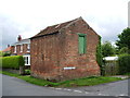
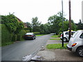
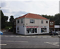
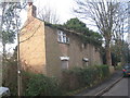
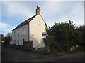
Photos of DN37 0PF


Area Information
Living in DN37 0PF means inhabiting a small, tightly knit residential cluster in England’s Lincolnshire region. Covering just 9.1 hectares, this area is compact yet functional, with a population of 1,672 people spread across a density of 361 per square kilometre. It is not a sprawling suburb but a focused community where daily life is shaped by proximity to local amenities and transport links. The area’s character is defined by its mix of older housing stock and practical infrastructure, catering to a demographic that values stability and accessibility. With no major natural constraints or planning restrictions, DN37 0PF offers a straightforward living experience, free from the complexities of protected landscapes or flood-prone zones. Its location near rail networks and retail hubs makes it a practical choice for those prioritising connectivity over sprawling green spaces. For buyers seeking a quiet, low-maintenance home with clear access to services, this postcode provides a balance of simplicity and convenience.
- Area Type
- Postcode
- Area Size
- 9.1 hectares
- Population
- 1672
- Population Density
- 361 people/km²
The property market in DN37 0PF is characterised by high home ownership—90% of residents own their homes—suggesting a community that prioritises stability and long-term investment. The accommodation type is predominantly houses, which implies a focus on traditional, standalone properties rather than apartments or flats. This makes the area more appealing to buyers seeking private, spacious living rather than rental-focused developments. With a population of 1,672 spread across 9.1 hectares, the housing stock is likely to be relatively modest in scale, with limited scope for large-scale new builds. For buyers, this means a market where properties are likely to be in established condition, with potential for value retention due to the low turnover and strong ownership rates. However, the small area size and limited new development opportunities may restrict choice, making it essential for buyers to act quickly when suitable properties arise.
House Prices in DN37 0PF
Showing 5 properties
| Address | Type | Beds | Baths | Last Sale Price | Last Sale Date | |
|---|---|---|---|---|---|---|
| 5 Shears Court, Waltham, DN37 0PF | Detached | 3 | 2 | £378,000 | Aug 2025 | |
| 4 Shears Court, Waltham, DN37 0PF | house | 3 | 2 | £330,000 | Mar 2017 | |
| 3 Shears Court, Waltham, DN37 0PF | Bungalow | - | - | £310,000 | Jun 2007 | |
| 2 Shears Court, Waltham, DN37 0PF | Detached | - | - | £249,000 | Mar 2006 | |
| 1 Shears Court, Waltham, DN37 0PF | Detached | - | - | £122,500 | Aug 1998 |
Energy Efficiency in DN37 0PF
Daily life in DN37 0PF is supported by a range of nearby amenities within practical reach. The retail sector includes five notable venues such as Spar, Lincolnshire Co-operative Co, and Asda Toll, providing essential shopping and services. For transport, the area’s rail network offers five stations, including Grimsby Town and Cleethorpes, connecting residents to broader regional hubs. While the data does not specify parks or leisure facilities, the absence of protected natural areas suggests a focus on practical living rather than recreational landscapes. The combination of retail, rail, and digital connectivity ensures a lifestyle that prioritises convenience and accessibility, making it suitable for those who value functional, no-frills living without sacrificing essential services.
Amenities
Schools
| Rank | School | Type | Entry gender | Ages |
|---|
Explore more schools in this area
Go to Schools tabDemographics
DN37 0PF has a median age of 47, with the majority of residents falling into the 30-64 age range. This suggests a community of established adults, many of whom are likely to be in their prime working years or nearing retirement. Home ownership is exceptionally high at 90%, indicating a strong preference for long-term residency over renting. The accommodation type is predominantly houses, reflecting a preference for standalone properties over flats or apartments. The predominant ethnic group is White, which aligns with broader trends in the region. The population density of 361 per square kilometre means the area is neither overcrowded nor sparse, offering a middle ground between urban and rural living. This demographic profile suggests a stable, mature community with a focus on family-oriented or independent living, where property values are likely to hold their value due to the high ownership rate and low turnover.
Household Size
Accommodation Type
Tenure
Ethnic Group
Religion
Household Composition
Age
Household Deprivation
NS-SEC
Explore more demographic insights in this area
Go to Demographics tabPlanning
Planning Constraints
- Flood RiskPremium
- Ramsar Wetland SitesPremium
- Area of Outstanding Natural BeautyPremium
- Protected Nature ReservePremium
- Protected WoodlandPremium