Area Overview for DN37 0NW
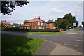
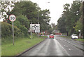
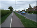
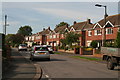
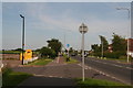
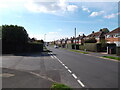
Photos of DN37 0NW


Area Information
DN37 0NW is a small, tightly packed residential postcode in England, covering just 4167 m² and home to 1137 residents. Its high population density of 272,885 people per square kilometre reflects a compact, closely knit community. This area is defined by its modest scale and residential focus, with homes forming the primary accommodation type. Daily life here is shaped by proximity to local amenities and a quiet, established character. The area lacks major urban infrastructure but offers a sense of simplicity and accessibility. For those seeking a low-key, community-oriented environment, DN37 0NW provides a straightforward living experience, with limited commercial or industrial development. Its small size means residents are likely to know their neighbours, and the area’s boundaries are clearly defined. While it may not cater to those needing sprawling spaces, it suits those prioritising convenience and a stable, familiar setting. The presence of nearby schools and rail links adds practicality to its appeal.
- Area Type
- Postcode
- Area Size
- 4167 m²
- Population
- 1137
- Population Density
- 1633 people/km²
The property market in DN37 0NW is characterised by a 55% home ownership rate, with houses forming the dominant accommodation type. This suggests a focus on owner-occupied properties rather than a rental market, though the small area size and limited data mean the exact balance of rental versus sale properties is unclear. The presence of houses, rather than flats, indicates a preference for standalone homes, which may appeal to buyers seeking space and privacy. Given the area’s compact nature, property values are likely to be modest, with limited scope for large-scale development. For buyers, this means a straightforward market with few speculative opportunities but a stable, low-maintenance environment. The small footprint of DN37 0NW also means that properties are likely to be closely spaced, offering convenience but little room for expansion.
House Prices in DN37 0NW
Showing 10 properties
| Address | Type | Beds | Baths | Last Sale Price | Last Sale Date | |
|---|---|---|---|---|---|---|
| 6 Norsefield Avenue, Waltham, DN37 0NW | Bungalow | - | - | - | - | |
| 4 Norsefield Avenue, Waltham, DN37 0NW | Bungalow | - | - | - | - | |
| 14 Norsefield Avenue, Waltham, DN37 0NW | Bungalow | - | - | - | - | |
| 16 Norsefield Avenue, Waltham, DN37 0NW | Bungalow | - | - | - | - | |
| 12 Norsefield Avenue, Waltham, DN37 0NW | Bungalow | - | - | - | - | |
| 2 Norsefield Avenue, Waltham, DN37 0NW | Bungalow | - | - | - | - | |
| 10 Norsefield Avenue, Waltham, DN37 0NW | Bungalow | - | - | - | - | |
| 18 Norsefield Avenue, Waltham, DN37 0NW | Bungalow | - | - | - | - | |
| 8 Norsefield Avenue, Waltham, DN37 0NW | Bungalow | - | - | - | - | |
| 20 Norsefield Avenue, Waltham, DN37 0NW | Bungalow | - | - | - | - |
Energy Efficiency in DN37 0NW
The lifestyle in DN37 0NW is shaped by its proximity to essential amenities. Within practical reach are five retail outlets, including Lincolnshire Co-operative Co and Spar, offering everyday shopping needs. The rail network provides connections to Grimsby Town, Grimsby Docks, and New Clee stations, enabling travel to nearby towns and employment hubs. While the area lacks major leisure or entertainment facilities, its compact size ensures residents can access local services without long commutes. The presence of multiple schools and a stable community suggests a focus on family life and routine. However, the absence of parks or recreational spaces is notable, which may be a consideration for those prioritising outdoor activities. Overall, the area supports a simple, functional lifestyle with minimal excess.
Amenities
Schools
Residents of DN37 0NW have access to several primary schools, including The Leas Junior School, The Leas Infants’ School, Waltham Leas Primary School, and Waltham Leas Primary Academy. The latter holds an Ofsted rating of ‘good’, indicating a reliable standard of education. The concentration of primary schools suggests the area is well-served for families with young children, though no secondary schools are listed in the data. The presence of multiple primary options may reduce competition for places and provide flexibility for parents. However, the absence of secondary schooling nearby could require families to commute for older children. The overall mix of schools reflects a focus on early education, which aligns with the area’s demographic profile of middle-aged adults and families.
| Rank | School | Type | Entry gender | Ages |
|---|
Explore more schools in this area
Go to Schools tabDemographics
The population of DN37 0NW has a median age of 47, with the majority of residents aged between 30 and 64. This suggests a mature, settled community with a strong presence of middle-aged adults. Home ownership stands at 55%, indicating a mix of owner-occupied and rented properties. The area is predominantly composed of houses, rather than flats or apartments, which aligns with its residential character. The predominant ethnic group is White, reflecting a homogenous demographic profile. With no specific data on deprivation levels, it is reasonable to infer that the area’s stability and moderate population density contribute to a baseline quality of life. The age distribution implies a community with established careers and families, though younger or older demographics are less represented. This profile may appeal to those seeking a quiet, unchanging environment rather than a rapidly evolving one.
Household Size
Accommodation Type
Tenure
Ethnic Group
Religion
Household Composition
Age
Household Deprivation
NS-SEC
Explore more demographic insights in this area
Go to Demographics tabPlanning
Planning Constraints
- Flood RiskPremium
- Ramsar Wetland SitesPremium
- Area of Outstanding Natural BeautyPremium
- Protected Nature ReservePremium
- Protected WoodlandPremium