Area Overview for DN37 0HN
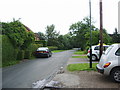
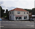
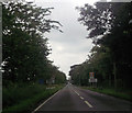
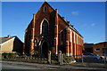
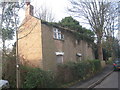
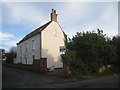
Photos of DN37 0HN

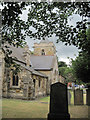
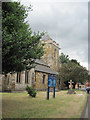
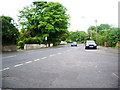
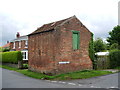

Area Information
Living in DN37 0HN means inhabiting a tightly knit residential cluster in England, where 1,375 people reside across just 4,287 square metres. The area’s high population density — 320,703 people per square kilometre — reflects its compact nature, yet it offers a quiet, low-traffic environment. This postcode is defined by its proximity to rail networks, with five nearby stations, including Grimsby Town and Cleethorpes, providing easy access to regional hubs. Daily life here is shaped by a mature demographic, with residents predominantly aged 30–64, many of whom own their homes. The area’s safety profile is strong, with a crime risk score of 84, indicating below-average incidents. While there are no protected natural sites or flood risks, the absence of such constraints means planning restrictions are minimal. For buyers, DN37 0HN presents a blend of practicality and security, with essential retail amenities like Spar and Lincolnshire Co-operative Co within reach. Its small size ensures a close-knit community feel, though the limited housing stock means properties here are likely to be long-term investments.
- Area Type
- Postcode
- Area Size
- 4287 m²
- Population
- 1375
- Population Density
- 3078 people/km²
The property market in DN37 0HN is characterised by high home ownership — 86% of residents own their homes — and a housing stock composed entirely of houses. This suggests a market skewed towards owner-occupation rather than rental, with limited availability of apartments or flats. The area’s small size, covering just 4,287 square metres, means the housing stock is finite, and properties are likely to be long-term investments. Buyers should consider the proximity to rail networks, with five nearby stations offering connections to Grimsby, Cleethorpes, and beyond. The absence of planning constraints, such as protected nature reserves or flood risks, makes the area appealing for those seeking a secure, low-maintenance property. However, the compact nature of DN37 0HN means there is little scope for expansion or new developments, which could limit options for buyers seeking larger homes or additional properties in the immediate vicinity.
House Prices in DN37 0HN
Showing 6 properties
| Address | Type | Beds | Baths | Last Sale Price | Last Sale Date | |
|---|---|---|---|---|---|---|
| Winchester House, 36 Cheapside, Waltham, DN37 0HN | house | 3 | - | £315,000 | Jul 2016 | |
| 42 Cheapside, Waltham, DN37 0HN | Bungalow | 2 | - | £177,500 | Nov 2010 | |
| 46 Cheapside, Waltham, DN37 0HN | Detached | - | - | £97,000 | Jul 1995 | |
| 38 Cheapside, Waltham, DN37 0HN | Detached | - | - | - | - | |
| 44 Cheapside, Waltham, DN37 0HN | house | - | - | - | - | |
| 40 Cheapside, Waltham, DN37 0HN | Detached | - | - | - | - |
Energy Efficiency in DN37 0HN
The lifestyle in DN37 0HN is shaped by its proximity to essential retail and transport hubs. Within practical reach are five retail outlets, including Spar and two branches of Lincolnshire Co-operative Co, offering everyday shopping needs. The area’s rail network, with stations such as Grimsby Town and Cleethorpes, provides easy access to nearby towns and cities, supporting both commuting and leisure travel. While there are no named parks or leisure facilities in the data, the absence of planning constraints means residents are not restricted by protected sites or environmental restrictions. The compact nature of the area means amenities are closely clustered, reducing the need for long journeys. This combination of retail convenience and transport links creates a functional, low-maintenance lifestyle, ideal for those prioritising accessibility over expansive recreational spaces.
Amenities
Schools
| Rank | School | Type | Entry gender | Ages |
|---|
Explore more schools in this area
Go to Schools tabDemographics
The community in DN37 0HN is predominantly composed of adults aged 30–64, with a median age of 47. This suggests a stable, mature population, likely with established careers and families. Home ownership is exceptionally high at 86%, indicating a strong preference for private residence over renting. The area is almost entirely composed of houses, with no mention of flats or apartments, which aligns with the demographic profile of older, settled residents. The predominant ethnic group is White, though no further breakdown of diversity is provided. The population density of 320,703 people per square kilometre is strikingly high, yet the area’s small size — just 4,287 square metres — means it is a tightly packed cluster rather than a sprawling suburb. This density, combined with high home ownership, suggests a self-contained community with limited external influence. Residents here are likely to value privacy and stability, with little need for commuting beyond the immediate rail links.
Household Size
Accommodation Type
Tenure
Ethnic Group
Religion
Household Composition
Age
Household Deprivation
NS-SEC
Explore more demographic insights in this area
Go to Demographics tabPlanning
Planning Constraints
- Flood RiskPremium
- Ramsar Wetland SitesPremium
- Area of Outstanding Natural BeautyPremium
- Protected Nature ReservePremium
- Protected WoodlandPremium