Area Overview for DN37 0HB
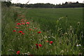
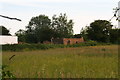
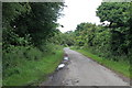
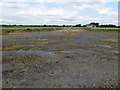
Photos of DN37 0HB

Area Information
DN37 0HB is a small, tightly knit residential area in England, covering just 50.4 hectares with a population of 1672 people. Its compact size means it feels intimate, with a population density of 361 people per square kilometre. This is a mature community, with a median age of 47 and the majority of residents aged between 30 and 64. The area is predominantly home to owner-occupied houses, reflecting a stable, long-term presence of families and individuals. Daily life here is characterised by proximity to essential services and a low crime rate, making it appealing for those seeking a quiet, secure place to live. The area’s small footprint means it is likely surrounded by open countryside or less densely populated zones, offering a balance between residential comfort and natural surroundings. For those considering living in DN37 0HB, the combination of safety, strong home ownership, and practical amenities makes it a compelling choice for buyers looking for a settled, community-focused environment.
- Area Type
- Postcode
- Area Size
- 50.4 hectares
- Population
- 1672
- Population Density
- 361 people/km²
The property market in DN37 0HB is dominated by owner-occupied homes, with 90% of properties owned by their residents. This high rate of home ownership points to a community that values stability and long-term investment. The accommodation type is predominantly houses, which are typically larger and more suited to families or individuals seeking space. Given the area’s small size and limited population, the housing stock is likely to be limited in number, with few new developments. This makes the market relatively niche, with properties in high demand among buyers seeking a secure, low-risk investment. For those considering purchasing in DN37 0HB, the focus on owner-occupation and traditional housing means the area is less likely to attract short-term renters or speculative buyers. The compact nature of the area also means that properties are likely to be in close proximity to each other, offering a sense of community but potentially limiting options for those seeking larger plots or specific architectural styles.
House Prices in DN37 0HB
Showing 16 properties
| Address | Type | Beds | Baths | Last Sale Price | Last Sale Date | |
|---|---|---|---|---|---|---|
| The Lodge, 38 Ings Lane, Waltham, DN37 0HB | Detached | 6 | 5 | £1,250,000 | Jun 2024 | |
| 28 Ings Lane, Waltham, DN37 0HB | house | 4 | 3 | £795,000 | Jun 2023 | |
| 30 Ings Lane, Waltham, DN37 0HB | house | - | - | £580,000 | Mar 2021 | |
| 40 Ings Lane, Waltham, DN37 0HB | house | - | - | £550,000 | Jul 2019 | |
| Eastwell Oaks, Ings Lane, Waltham, DN37 0HB | Bungalow | 3 | 1 | £250,000 | Jul 2018 | |
| Hollie Croft, 36 Ings Lane, Waltham, DN37 0HB | house | - | - | £435,000 | Aug 2014 | |
| The Old Tanyard, Ings Lane, Waltham, DN37 0HB | Detached | - | - | £200,000 | Jul 2009 | |
| Field View, Ings Lane, Waltham, DN37 0HB | Detached | - | - | £295,000 | Feb 2007 | |
| Bridge House, Ings Lane, Waltham, DN37 0HB | house | 5 | 4 | £370,000 | Jul 2004 | |
| 24 Ings Lane, Waltham, DN37 0HB | Detached | 4 | - | £249,000 | Jul 2001 |
Energy Efficiency in DN37 0HB
Living in DN37 0HB offers access to a range of practical amenities within easy reach. The area is served by five retail outlets, including Asda Toll, Spar, and Morrisons Daily, providing residents with essential shopping options for groceries and everyday needs. These stores are likely to be within walking or short driving distance, enhancing convenience for daily errands. The presence of multiple rail stations, such as Grimsby Town and Cleethorpes, adds to the area’s accessibility, allowing residents to travel to nearby towns for work, leisure, or social activities. While the data does not specify parks or leisure facilities, the absence of protected natural areas suggests that the area may be more focused on residential comfort than outdoor recreation. Nonetheless, the combination of retail and rail connectivity ensures a lifestyle that balances practicality with ease of movement, making DN37 0HB suitable for those who prioritise accessibility and convenience.
Amenities
Schools
| Rank | School | Type | Entry gender | Ages |
|---|
Explore more schools in this area
Go to Schools tabDemographics
The community in DN37 0HB is predominantly composed of adults aged 30 to 64, with a median age of 47. This suggests a population skewed towards middle-aged individuals, many of whom may be in their peak earning years or raising families. Home ownership is exceptionally high at 90%, indicating a strong preference for long-term residency over renting. The area is almost entirely made up of houses, rather than flats or other forms of accommodation, which aligns with the demographic profile of established households. The predominant ethnic group is White, with no specific data provided on other groups. This high level of home ownership and the presence of family-oriented housing suggest a stable, low-turnover community. The absence of detailed diversity statistics means the area’s social composition remains largely defined by its core demographic, but the data confirms a cohesive, settled population.
Household Size
Accommodation Type
Tenure
Ethnic Group
Religion
Household Composition
Age
Household Deprivation
NS-SEC
Explore more demographic insights in this area
Go to Demographics tabPlanning
Planning Constraints
- Flood RiskPremium
- Ramsar Wetland SitesPremium
- Area of Outstanding Natural BeautyPremium
- Protected Nature ReservePremium
- Protected WoodlandPremium