Area Overview for DN36 4LN
Photos of DN36 4LN
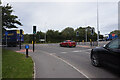
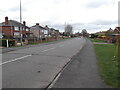
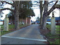
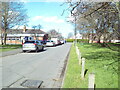
19 photos from this area
Area Information
Key information about the DN36 4LN including its size, population, and administrative classification.
- Area Type
- Postcode
- Area Size
- 1.5 hectares
- Population
- 1438
- Population Density
- 648 people/km²
House Prices in DN36 4LN
20
Properties
£220,157
Average Sold Price
£41,250
Lowest Price
£380,000
Highest Price
Showing 20 properties
| Address | Type | Beds | Baths | Last Sale Price | Last Sale Date | |
|---|---|---|---|---|---|---|
| 40 Peaks Avenue, New Waltham, DN36 4LN | house | - | - | £320,000 | Dec 2024 | |
| 37A Peaks Avenue, New Waltham, DN36 4LN | Semi-detached | 3 | 1 | £229,950 | Sep 2024 | |
| 21 Peaks Avenue, New Waltham, DN36 4LN | Semi-detached | 3 | 1 | £156,000 | Apr 2024 | |
| 39 Peaks Avenue, New Waltham, DN36 4LN | Bungalow | 2 | 1 | £265,000 | Oct 2020 | |
| 36 Peaks Avenue, New Waltham, DN36 4LN | house | 2 | - | £380,000 | Mar 2020 | |
| 35 Peaks Avenue, New Waltham, DN36 4LN | Detached | 6 | 2 | £270,000 | Dec 2019 | |
| 62 Peaks Avenue, New Waltham, DN36 4LN | house | - | - | £240,000 | Sep 2017 | |
| 46 Peaks Avenue, New Waltham, DN36 4LN | Bungalow | - | - | £215,000 | Mar 2017 | |
| 29 Peaks Avenue, New Waltham, DN36 4LN | Detached | 4 | 3 | £270,000 | Jun 2011 | |
| 34 Peaks Avenue, New Waltham, DN36 4LN | Semi-detached | - | - | £150,000 | Aug 2008 |
Page 1 of 2
Energy Efficiency in DN36 4LN
Amenities
Schools
| Rank | School | Type | Entry gender | Ages |
|---|
Explore more schools in this area
Go to Schools tabDemographics
Household Size
Two person
most common
Accommodation Type
Houses
most common
Tenure
80
majority
Ethnic Group
White
most common
Religion
N/A
most common
Household Composition
N/A
most common
Age
47
median
Adults (30-64 years)
most common
Household Deprivation
N/A
with no deprivation
NS-SEC
29
in Lower managerial occupations
Explore more demographic insights in this area
Go to Demographics tabPlanning
Planning Constraints
- Flood RiskPremium
- Ramsar Wetland SitesPremium
- Area of Outstanding Natural BeautyPremium
- Protected Nature ReservePremium
- Protected WoodlandPremium