Area Overview for DN36 4GS
Photos of DN36 4GS
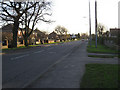
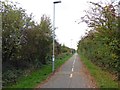

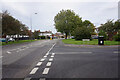

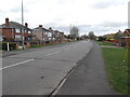


19 photos from this area
Area Information
Key information about the DN36 4GS including its size, population, and administrative classification.
- Area Type
- Postcode
- Area Size
- 6722 m²
- Population
- 1836
- Population Density
- 932 people/km²
House Prices in DN36 4GS
16
Properties
£180,340
Average Sold Price
£84,250
Lowest Price
£268,500
Highest Price
Showing 16 properties
| Address | Type | Beds | Baths | Last Sale Price | Last Sale Date | |
|---|---|---|---|---|---|---|
| 5 Newlyn Close, New Waltham, DN36 4GS | house | - | - | £268,500 | Jun 2024 | |
| 15 Newlyn Close, New Waltham, DN36 4GS | Retail | 4 | 2 | £255,000 | Mar 2022 | |
| 14 Newlyn Close, New Waltham, DN36 4GS | Detached | 4 | 2 | £225,000 | Aug 2017 | |
| 2 Newlyn Close, New Waltham, DN36 4GS | house | - | - | £196,000 | Nov 2016 | |
| 3 Newlyn Close, New Waltham, DN36 4GS | house | 4 | - | £180,000 | May 2014 | |
| 7 Newlyn Close, New Waltham, DN36 4GS | house | 4 | - | £189,950 | Jun 2013 | |
| 4 Newlyn Close, New Waltham, DN36 4GS | Detached | 4 | - | £200,000 | Feb 2013 | |
| 11 Newlyn Close, New Waltham, DN36 4GS | Detached | 4 | - | £183,750 | Jul 2010 | |
| 12 Newlyn Close, New Waltham, DN36 4GS | Detached | - | - | £219,995 | Nov 2007 | |
| 16 Newlyn Close, New Waltham, DN36 4GS | house | 4 | 2 | £173,000 | Jun 2006 |
Page 1 of 2
Energy Efficiency in DN36 4GS
Amenities
Schools
| Rank | School | Type | Entry gender | Ages |
|---|
Explore more schools in this area
Go to Schools tabDemographics
Household Size
Family (3-5 people)
most common
Accommodation Type
Houses
most common
Tenure
93
majority
Ethnic Group
White
most common
Religion
N/A
most common
Household Composition
N/A
most common
Age
47
median
Adults (30-64 years)
most common
Household Deprivation
N/A
with no deprivation
NS-SEC
36
in Lower managerial occupations
Explore more demographic insights in this area
Go to Demographics tabPlanning
Planning Constraints
- Flood RiskPremium
- Ramsar Wetland SitesPremium
- Area of Outstanding Natural BeautyPremium
- Protected Nature ReservePremium
- Protected WoodlandPremium