Area Overview for DN35 9QG
Photos of DN35 9QG
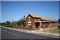
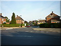
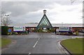
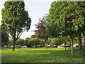
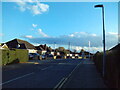
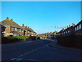
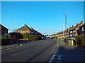
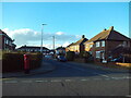
30 photos from this area
Area Information
Key information about the DN35 9QG including its size, population, and administrative classification.
- Area Type
- Postcode
- Area Size
- 9583 m²
- Population
- 1286
- Population Density
- 3535 people/km²
House Prices in DN35 9QG
20
Properties
£147,215
Average Sold Price
£100,000
Lowest Price
£193,000
Highest Price
Showing 20 properties
| Address | Type | Beds | Baths | Last Sale Price | Last Sale Date | |
|---|---|---|---|---|---|---|
| 12 Haverstoe Place, Cleethorpes, DN35 9QG | Semi-detached | 3 | 1 | £193,000 | Aug 2025 | |
| 4 Haverstoe Place, Cleethorpes, DN35 9QG | Bungalow | - | - | £145,000 | Jul 2020 | |
| 20 Haverstoe Place, Cleethorpes, DN35 9QG | Bungalow | - | - | £140,000 | Jul 2020 | |
| 9 Haverstoe Place, Cleethorpes, DN35 9QG | Bungalow | - | - | £162,950 | Jun 2018 | |
| 15 Haverstoe Place, Cleethorpes, DN35 9QG | Bungalow | - | - | £158,000 | Dec 2015 | |
| 19 Haverstoe Place, Cleethorpes, DN35 9QG | Semi-detached | 3 | 1 | £147,000 | Dec 2014 | |
| 5 Haverstoe Place, Cleethorpes, DN35 9QG | Bungalow | 2 | - | £124,950 | Jun 2014 | |
| 17 Haverstoe Place, Cleethorpes, DN35 9QG | Semi-detached | 3 | - | £135,000 | Mar 2014 | |
| 13 Haverstoe Place, Cleethorpes, DN35 9QG | Semi-detached | - | - | £179,950 | Nov 2007 | |
| 10 Haverstoe Place, Cleethorpes, DN35 9QG | Semi-detached | - | - | £162,950 | Aug 2007 |
Page 1 of 2
Energy Efficiency in DN35 9QG
Amenities
Schools
| Rank | School | Type | Entry gender | Ages |
|---|
Explore more schools in this area
Go to Schools tabDemographics
Household Size
Two person
most common
Accommodation Type
Houses
most common
Tenure
91
majority
Ethnic Group
White
most common
Religion
N/A
most common
Household Composition
N/A
most common
Age
47
median
Elderly (65+ years)
most common
Household Deprivation
N/A
with no deprivation
NS-SEC
28
in Lower managerial occupations
Explore more demographic insights in this area
Go to Demographics tabPlanning
Planning Constraints
- Flood RiskPremium
- Ramsar Wetland SitesPremium
- Area of Outstanding Natural BeautyPremium
- Protected Nature ReservePremium
- Protected WoodlandPremium