Area Overview for DN35 8XH
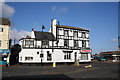
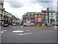
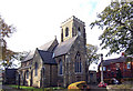
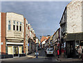
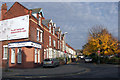
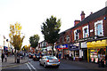
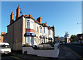
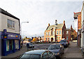
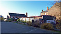
Photos of DN35 8XH


Area Information
Living in DN35 8XH means being part of a small, tightly knit residential cluster in England, home to 1,498 people. This area is characterised by its modest scale, offering a quiet, low-density living environment. The community is predominantly composed of adults aged 30–64, with a median age of 47, suggesting a mature, stable population. While the area lacks the vibrancy of larger towns, its proximity to Cleethorpes and Grimsby provides access to urban amenities without the congestion. Residents benefit from excellent digital connectivity, with broadband scores near 100, making remote work and online activities seamless. The area’s small size means a close-knit feel, though it is not without challenges—crime rates are average, requiring standard security measures. For those seeking a peaceful, manageable environment with practical access to nearby towns, DN35 8XH offers a straightforward, no-frills lifestyle.
- Area Type
- Postcode
- Area Size
- Not available
- Population
- 1498
- Population Density
- 8322 people/km²
The property market in DN35 8XH is defined by a 45% home ownership rate, meaning most residents rent rather than own their homes. The area is dominated by houses, not flats or apartments, which is typical of smaller rural or semi-rural clusters. This suggests a housing stock that prioritises family-friendly, standalone properties over high-density living. The limited population size means the market is small, with few new developments. For buyers, this presents a challenge: competition for existing homes is likely to be low, but the pool of available properties is also constrained. The predominance of rental properties may indicate that the area is not a strong investment for owner-occupiers seeking long-term capital growth. Those considering purchasing should focus on the existing stock of houses, which may offer more space and privacy than larger towns but with fewer amenities nearby.
House Prices in DN35 8XH
No properties found in this postcode.
Energy Efficiency in DN35 8XH
The lifestyle in DN35 8XH is shaped by its proximity to practical amenities, including retail outlets such as Co-op Cleethorpes, Heron Cleethorpes, and Sainsburys Cleethorpes. These stores provide essential shopping options, though the variety is modest compared to larger towns. The area’s rail network, with stations like Cleethorpes and New Clee, offers access to broader regional services, including bus routes and connections to Grimsby. While there are no named parks or leisure facilities in the immediate area, the nearby towns of Cleethorpes and Grimsby offer more extensive options. The character of daily life here is defined by simplicity: residents can meet basic needs locally but must travel for more specialised services. This makes DN35 8XH ideal for those prioritising quiet living over urban convenience.
Amenities
Schools
| Rank | School | Type | Entry gender | Ages |
|---|
Explore more schools in this area
Go to Schools tabDemographics
The population of DN35 8XH is 1,498, with a median age of 47 and the majority of residents aged between 30 and 64. This suggests a community of middle-aged adults, likely with established careers and families. Home ownership is relatively low at 45%, indicating that a larger proportion of residents rent their homes. The area is predominantly composed of houses, not flats, reflecting a traditional housing stock. The predominant ethnic group is White, with no specific data provided on other groups. The absence of detailed diversity statistics means the community’s composition is largely homogeneous. For those considering life here, the age profile and ownership rates suggest a stable, mature population with limited turnover. The lack of high-density housing also implies a quieter, more spread-out living environment compared to urban areas.
Household Size
Accommodation Type
Tenure
Ethnic Group
Religion
Household Composition
Age
Household Deprivation
NS-SEC
Explore more demographic insights in this area
Go to Demographics tabPlanning
Planning Constraints
- Flood RiskPremium
- Ramsar Wetland SitesPremium
- Area of Outstanding Natural BeautyPremium
- Protected Nature ReservePremium
- Protected WoodlandPremium