Area Overview for DN35 7AN
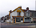
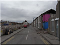
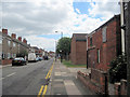
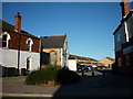
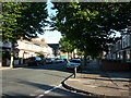
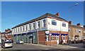
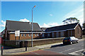
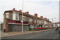
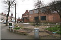
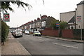
Photos of DN35 7AN


Area Information
Living in DN35 7AN offers a quiet, residential experience within a small cluster of homes. With a population of 1,535, the area is compact, fostering a close-knit community feel. Situated in England, it is a low-density postcode where daily life revolves around local amenities and straightforward living. The area’s character is defined by its modest scale, with homes primarily occupied by adults aged 30–64, reflecting a mature demographic. While there is no formal designation as a conservation or natural area, residents benefit from low flood risk and minimal planning constraints. The absence of protected sites or wetlands means development pressures are low, though this also means the area lacks natural landmarks. For those prioritising safety, the flood risk is negligible, but crime rates are a concern, with scores indicating high risk. Despite this, the area’s proximity to rail networks and retail hubs like Tesco Cleethorpes and Aldi East provides practical convenience. DN35 7AN is not for those seeking vibrant urban life, but it suits buyers looking for simplicity, affordability, and proximity to essential services.
- Area Type
- Postcode
- Area Size
- Not available
- Population
- 1535
- Population Density
- 12087 people/km²
The property market in DN35 7AN is characterised by a low home ownership rate of 35%, suggesting a higher proportion of rental properties compared to owner-occupied homes. This may reflect the area’s modest scale and limited appeal to investors seeking high-yield assets. The accommodation type is predominantly houses, which is atypical for a small postcode but could indicate a focus on family homes or detached properties. Given the low population density and compact size, the housing stock is likely limited to a handful of properties, making the market niche. For buyers, this means fewer options but potentially less competition. The lack of planning constraints or environmental designations may also make the area more accessible for development, though the high crime risk could deter some buyers. Those considering DN35 7AN should weigh the practicality of its location against the need for enhanced security measures. The market is unlikely to cater to high-end buyers, instead serving those seeking affordable, straightforward housing in a rural or semi-rural setting.
House Prices in DN35 7AN
No properties found in this postcode.
Energy Efficiency in DN35 7AN
Residents of DN35 7AN have access to a modest range of amenities within practical reach. The retail sector includes stores like Tesco Cleethorpes, Aldi East, and Heron Grimsby, providing essential shopping options. These venues cater to daily needs, from groceries to household goods, reducing the necessity for long trips to larger towns. The rail network is a standout feature, with five stations including Cleethorpes Railway Station, offering connections to Grimsby and beyond. This makes the area suitable for commuters or those seeking access to regional services. However, there are no notable parks, leisure facilities, or dining options listed in the data, suggesting a focus on practicality over recreation. The absence of cultural or entertainment venues means the lifestyle is subdued, prioritising convenience over vibrancy. For buyers, this implies a trade-off between affordability and the desire for a more dynamic environment. The area’s appeal lies in its simplicity, but those seeking a rich social or cultural life may find it lacking.
Amenities
Schools
| Rank | School | Type | Entry gender | Ages |
|---|
Explore more schools in this area
Go to Schools tabDemographics
The community in DN35 7AN is predominantly composed of adults aged 30–64, with a median age of 47. This suggests a population largely in their prime working years, likely with established careers and families. Home ownership is relatively low at 35%, indicating a mix of renters and owner-occupiers. The accommodation type is primarily houses, which is unusual for a small postcode but may reflect a focus on single-family homes. The predominant ethnic group is White, though no specific data on diversity or deprivation is provided. This demographic profile implies a stable, middle-aged population with limited generational turnover. The lack of data on household composition or income levels means it is unclear whether the area has a high proportion of single-person households or multi-generational families. However, the low flood risk and absence of environmental constraints suggest a practical, no-frills lifestyle. For buyers, this demographic may indicate a market with fewer speculative investment properties and more long-term residents.
Household Size
Accommodation Type
Tenure
Ethnic Group
Religion
Household Composition
Age
Household Deprivation
NS-SEC
Explore more demographic insights in this area
Go to Demographics tabPlanning
Planning Constraints
- Flood RiskPremium
- Ramsar Wetland SitesPremium
- Area of Outstanding Natural BeautyPremium
- Protected Nature ReservePremium
- Protected WoodlandPremium